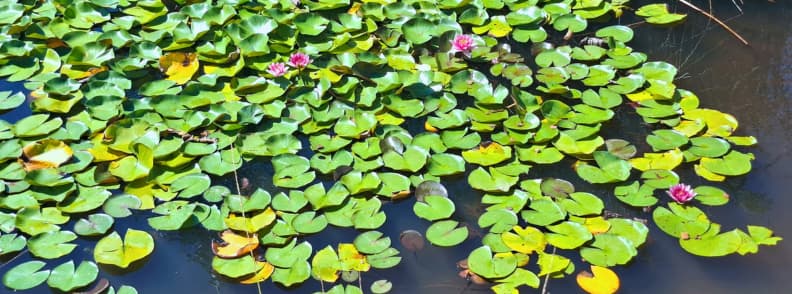
Red rock, cool shade, and a quiet lily pond. If you want a hike from Saint-Raphaël that feels special, this loop is it! It sits at the heart of Estérel Massif hiking and ranks high on French Riviera trails for a short day hike Saint-Raphael. Think red rock hiking through pines to a water lily pond Estérel. It links the Gratadis Ravine trail, the Col Aubert trail, and the Étang d’Aubert trail, starting at the Belle Barbe Pass hike near Agay.
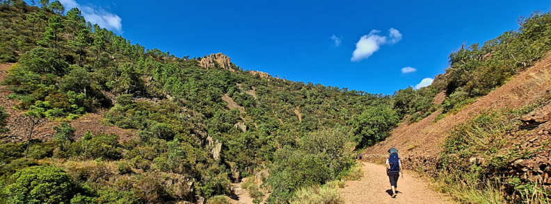
I walked the Visorando variant as a family loop and loved how forgiving it felt, even late morning. We set off on the hike Col Aubert from Belle Barbe Pass above Agay, followed the Ravin du Gratadis trail toward the Col Aubert, and reached the pond by a shaded spur. Moving time was a touch over two hours because we missed a river crossing and happily added an extra kilometer while our toddler set the pace. That shade was the surprise of the day, a steady cover that made the climb pleasant and the descent relaxed.
Hike to Etang d’Aubert and Col Aubert
In this guide, I’ll cover how to get to Étang d’Aubert, where to park for Étang d’Aubert hike, directions to Col Aubert trail head, and the real difficulty of hike to Col Aubert. I’ll also point you to guided tours in the Estérel Massif if you’d like a led outing. I’ll give you the exact cues to follow the trail, how to spot the turn after the ford, and how to find the waterfalls in Estérel when the streams are running. You’ll get notes on Agay hiking connections and ideas to chain this loop with coastal time.
If you want to go higher after, I’ll show you nearby classics like Cap Roux hike, Pic de l’Ours trail, and Mont Vinaigre hike. If you prefer sea air, I’ll point you at the coastal path Saint-Raphaël. If you only have half a day, this remains the best family hike near Saint-Raphael.
Disclosure: Some of the links below are affiliate links. This means that at no extra cost to you, The Travel Bunny will earn a small commission if you click through and make a purchase. Thank you!
Trail Details & Quick Facts at a Glance
This hike is a compact red-rock loop in the Estérel Massif that links the Ravin du Gratadis, Col d’Aubert, and Étang d’Aubert into one easy plan from Saint-Raphaël.
Expect an easy to moderate outing on classic Estérel hikes terrain with around 120 m of gentle gain over 4.9 km. The circuit works as a family walk Estérel or day hike Saint-Raphael, with shaded forest, a calm lily pond hike, and simple access from Agay.
Peak season runs from May to September when pink water lilies bloom, and you’ll find out later in this guide how to time your hike safely with Estérel fire risk checks.
If you’re choosing between Saint-Raphaël hiking trails, this loop is the sweet spot for short hike under 2 hours pace or a relaxed 1.5-2.5 hours with photo stops.
A Family-Friendly Loop from Belle Barbe
It’s a true loop, not an out-and-back, which keeps kids engaged and navigation simple. You move from shaded pine and cork oak to the red porphyry slopes above the pond, then close the circle back to Belle Barbe Pass. I hiked with a toddler and a grandma, missed a ford once, and still enjoyed the rhythm, which is why I flag this as a best family hike near Saint-Raphael for those weighing Estérel mountain hikes and Côte d’Azur hiking in one morning.
Pack light, carry water, and wear real shoes suited to a red rocks hike France surface.
Official vs. User-Reported Metrics
Official figures are tidy, and real hikes breathe. The route is 4.9 km with easy to moderate effort, yet community reports often read 1.5-2.5 hours depending on pace, photos, and small wanderings. If you’re asking how long is the hike to Ravin du Gratadis or how difficult is the hike to Col d’Aubert, I suggest you plan a relaxed pace and let the pond decide your pause.

Water Lilies in Bloom, the Reason Why This Estérel Hike is Special
This loop sits in the heart of Estérel Massif, a compact red rock hiking area that moves from cork oak and pine to open porphyry slopes before dropping to a quiet pond. It’s close to Agay and works as an easy hike on the broader Saint-Raphaël hiking trails and Côte d’Azur hiking network.
The lily pond Étang d’Aubert is the payoff. In season, pink water lilies in bloom carpet the surface, a rare sight on French Riviera trails. If you’ve wondered when do pink water lilies bloom, this is one of the few places where the answer matters for real photos and real scent.
Another highlight of this hike from Saint-Raphaël is that you get shade when you need it. The Ravin du Gratadis holds cool air, so even a late-morning start felt comfortable for us. I liked how the climb to Col d’Aubert offers breeze and patches of relief, which keeps this loop viable as a family walk Estérel and an easy hike with kids Estérel Massif.
Furthermore, this short loop offers real variety. You get streambeds, red gravel, and that lily-lined shore in a single circuit. In my husband’s words, this hike starts in Colorado, passes by Giverny, and finishes in Australia. It’s the kind of day hike from Saint-Raphael that lets you taste the massif without a long push, and it slots neatly alongside big-view options like Cap Roux hike, Pic de l’Ours trail, or Mont Vinaigre hike if you want a second outing.
Local Tip: For lilies at their best, arrive in the morning during peak season and stay on the bank. Treat Lake Aubert France as a no-swim spot to protect the blooms.
Getting to Colle de Belle Barbe
This trail starts in the heart of Estérel Massif hiking country, a quick hop from Agay on the Saint-Raphaël hiking trails network. If you’re planning a hike to Étang d’Aubert via Ravin du Gratadis, getting to Col de Belle Barbe is straightforward by car, train + taxi, or local bus, then a short lane up Route du Gratadis to the Agay trailhead.
Where to Park for Étang d’Aubert Hike
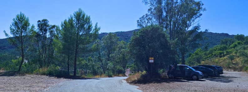
From Agay, take the D559 along the bay and at the Agay roundabout follow signs for Massif de l’Estérel. Pass under the small railway bridge, continue past the shops, then turn right on the lane signposted Massif de l’Estérel. Then, follow the signs to Col de Belle Barbe. The free parking is immediately on the flat area beside the barrier.
Coordinates for the Col de Belle Barbe Parking: 43.4566, 6.8688 (WGS84). They match IGN-mapped references for Parking (gratuit) du Col de Belle Barbe and are reliable for GPS and apps.
Directions to Col Aubert Trail Head from Saint-Raphaël
If you don’t have a car and you don’t bike, you could take the train (TER). There are frequent local trains that run from Saint-Raphaël-Valescure to Agay (about 9-10 minutes). From Agay station, take a short taxi up Route du Gratadis to Col de Belle Barbe. Unfortunately, the road into the massif is not served by regular buses, even in high season.
The local network (Estérel Côte d’Azur Le Bus) operates coastal lines to Agay Village (e.g., line 21 and line 07 on some timetables). It’s useful if you’re combining St Raphael hiking with beach time, but you’ll still need a taxi from the coast to the Col de Belle Barbe.
You can also take a taxi directly. Getting from Saint-Raphaël to Agay takes roughly 11-12 minutes. The taxi cost from Saint-Raphaël Valescure station should be around ~€23-30 for that coastal leg. Then, from Agay to Col de Belle Barbe add a short, metered ride up Route du Gratadis. Prices vary by time/day and operator. You can ask at Saint-Raphaël-Valescure or pre-book.
Keeps things simple by taking a train or bus to Agay, followed by a quick taxi to the parking Col de Belle Barbe. Then, open the Estérel Massif map, and you’re on one of the most photogenic Mediterranean hiking loops in the Var hiking trails, a circular hike in Estérel Massif with red rocks and a lily pond payoff.
Step-by-Step Trail Guide
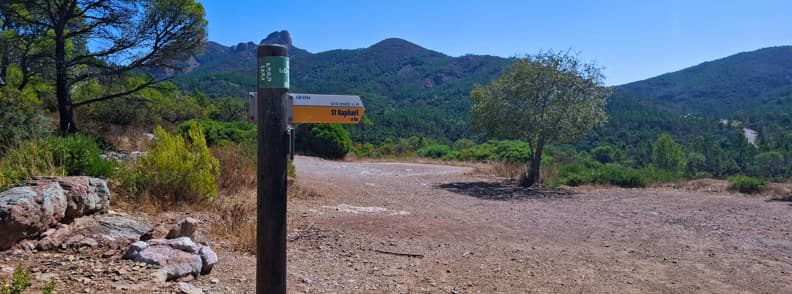
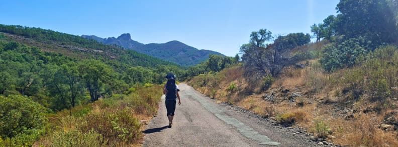
This loop is straightforward with waymarked trails and a clean GPX. From Belle Barbe you follow the barrier on GR653A with red-white and local yellow blazes, then switch onto the Ravin du Gratadis path into the Mal Infernet ravine before climbing to the Col d’Aubert pass.
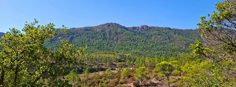
Getting to Col de Belle Barbe Parking
Arrive at the flat Col after Agay via Route du Gratadis and pull into Belle Barbe parking beside the barrier. We drove from Bagnols-en-Forêt and reached Col de Belle Barbe in about 40 minutes. On the way, we passed by a lot of cyclists cresting here from Saint-Raphaël because it’s a popular ridge point on Côte d’Azur hikes and rides.
At the Col de Belle Barbe, we parked in the shade of eucalyptus tree, and there was still a lot of room. The parking lot never filled while we were on the loop either.
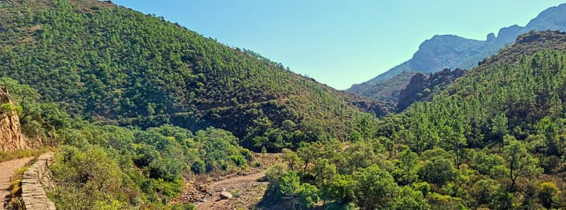
Col de Belle Barbe to Ravin du Gratadis (balisage notes)
Start at D/A 0.0 km, 45 m on the wide track behind the barrier, following GR653A red-white with yellow plates. After a gentle descent through cork oak and pine, reach the Gué du Grenouillet at 1.07 km, 20 m. Cross the ford, ignore the GR that branches right, and stay with the yellow waymarks to enter the shaded Ravin du Gratadis.
The path climbs above the Baladou stream, passes two old fountains, and a short cascade appears on the left when water is running. Watch for a painted yellow cue on a rock that indicates a left turn to the creek. We missed that turn once and wandered an extra kilometre, which was pleasant but unnecessary on this Mediterranean hiking loop.
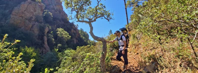
Up to Col d’Aubert
Drop to the Baladou stream, cross the small metal bridge without railings, and pick up the slender path that rises toward the pass. You can climb to Col d’Aubert with asphodels in spring, and the shade holds until the slope opens.
At 2.70 km, 113 m, you will reach Col d’Aubert. The junctions here can feel ambiguous. We found the correct continuation by spotting balisage on a rock rather than following the faint path. If in doubt, check the Estérel Massif map on your phone before leaving the saddle and confirm you are on the hike to Col d’Aubert line toward the pond.
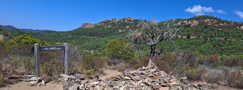
From Col Aubert to Étang d’Aubert
From the Col d’Aubert pass, the track dips back into scattered pines, then trends left toward the streamline. A small pond appears off-trail on your left, after which the path keeps the watercourse on your right. The footing remains typical red rocks gravel, workable for most parties with proper shoes. Questioning the difficulty of the hike to Col d’Aubert? It stays friendly if you keep a steady pace and watch the marbles underfoot.
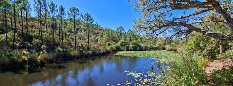
Descent to Étang d’Aubert, the Water Lily Pond
A short spur leads to the Étang d’Aubert shore where the pink water lilies bloom in season. Huge dragonflies hover over the pads and colorful butterflies flit along the bank, which makes this one of the best places to hike to see water lilies Estérel without a big effort. Please treat the pond as no-swim to protect the habitat.
If you want quiet photos, step back from the edge and use the trees for shade and reflection control.

Return options (loop vs out-and-back)
To complete the loop, keep the stream on your left and follow the path downstream past a shallow cascade, then climb gently to the old road at 4.11 km, 58 m. Turn left and enjoy the line of eucalyptus back to the Col de Belle Barbe. This avoids re-ascending to the pass and keeps the return via stream loop simple, even with kids or a mixed-ability group.
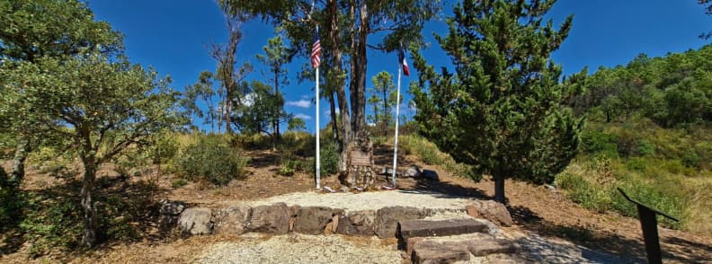
Near the Col de Belle Barbe car park there’s a small Chemin de Mémoire panel that stops you in your tracks. It tells the story of the B-24 Liberator Lucky Lady, part of the U.S. 15th Air Force, damaged during a mission on 25 May 1944. The crew was lost here in the Estérel sector. One airman survived, a detail the display explains alongside photos and a route map of other WW2 sites around Saint-Raphaël. If you’re hiking with kids, it’s a good moment to talk about the area’s recent history before rolling down from Col de Belle Barbe.
But if you are short on time or prefer certainty, skip the loop and retrace your steps to the Col d’Aubert and descend the same way. You can still walk to the memorial from the parking lot, it’s very close.
What To Do If You Get Lost
Stay calm, stop moving, and check your position against the GPS coordinates and offline maps. Load the Estérel GPX from Visorando before leaving the car so you can snap back to the recorded line within seconds.
On this loop, the two easiest errors are missing the left down to the creek after the ford and walking past the correct exit at the col. If you overshoot the ford turn, just retrace your steps and look for the painted yellow left turn to metal bridge.
If the Col d’Aubert area feels confusing, backtrack a few steps and scan for the rock with visible balisage rather than following the faint straight track. In a worst-case scenario, descend to the broad track you started on and follow it to the barrier at Col de Belle Barbe.
Keep water handy and use real footwear. The surface is classic for a hike in Estérel Massif with red rocks. Load the GPX, then enjoy one of the most compact and photogenic Var hiking trails.
Best Time for Gratadis Ravine Hike to Col Aubert & Etang d’Aubert
This is a seasonal gem in the heart of Estérel Massif hiking. Plan your Saint-Raphaël hike with water lilies for the warm months when the pond comes alive. If you are comparing Provence mountain trails, Var hiking trails, or wider Côte d’Azur hikes, this loop rewards those who time their day and light.
Water lilies at Étang d’Aubert typically bloom from late spring through summer, with pink flowers most reliable in July-September. Plan a morning hike for calm water and fewer insects.
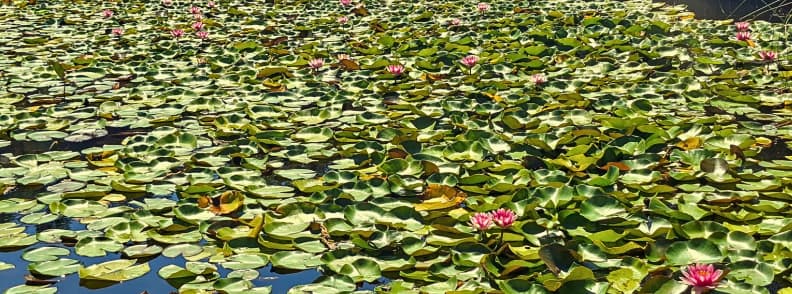
Water Lily Bloom Calendar (May-September)
May brings the first pads and early buds. June sees a steady opening, and the pond starts to read as a garden framed by pines. July to September are the safe bets for color, the period when most hikers can enjoy the water lilies Étang d’Aubert.
We were surprised to find pink lilies thriving even in the dry season, which makes this one of the easiest ways to hike to see water lilies Estérel without a long approach.
Morning is kinder to reflections and insects, and it aligns well with summer heat if you are choosing the best time to hike Estérel Massif.
Treat the surface as no-swim to protect blooms, even if the water looks tempting. On my visit, a whitish film sat on the far bank. It looked natural but not inviting. Yet another reason I answer can you swim in Étang d’Aubert with a polite no.
Photography Tips for Capturing the Perfect Shot
Soft morning light is the best light for water lily photography. Step back from the edge to avoid ripple and glare, then use the trees to frame pads and flowers. The red porphyry around the pond bounces warm tones, so expose for whites first and let the rock carry the scene.
I saw huge dragonflies hovering over the pads and a flutter of butterflies in varied colors, which adds scale and motion to still frames at classic photography spots water lilies Estérel.
Étang d’Aubert Photo Tip: Bring a polarizer if you shoot mid-morning. It tames glare on the pads without killing reflections.
Spring Wildflowers (March-May)
Spring shifts the focus from lilies to Mediterranean flora. Asphodels line the slope toward the pass, and the understorey carries that clean pine scent you expect on Mediterranean hiking. If you are exploring broader Esterel hiking trails in shoulder season, this loop works as a floral sampler before the pads open. It is a calm preview of summer color, close to the coast and easy to bundle with time on the walking trail Saint-Raphaël coastal path, if you want sea air later.
Étang d’Aubert Hiking Tip: Start early in spring for quiet paths and gentle temperatures, then save lily close-ups for a return visit in July-September.
Safety, Fire Risk, Weather & Closures
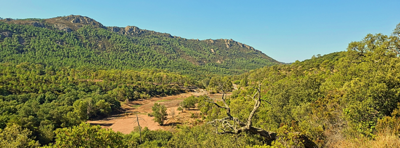
This loop sits in a Mediterranean zone where summer heat and wind can close trails with little notice. Treat every outing like summer hiking in France on the coast: check the day’s risk level for the Estérel, plan shade and water, and carry an offline map so a brief detour in the ravine does not turn into a long walk in rising temperatures. The rules apply across Provence mountain trails, Var hiking trails, and the wider Côte d’Azur hikes network.
Summer Hiking France
Access to the Estérel varies according to daily fire danger. The Prefecture du Var publishes the fire risk official map each evening for the following day. When the color for the Estérel massif shifts to severe, access can be restricted or closed outright. On exceptional days, it is closed all day to walkers and vehicles.
The department’s map is updated before 19:00 and mirrored on the Prefecture’s channels. A national interactive risk map is also available on the Meteo France portal. Check both before you leave the car park.
I check the fire risk on the Estérel Massif map before every hike. I checked it on the day we walked the loop, and it confirmed the Estérel was open.
Safety Tips in Heat and Mistral
Wind is the wild card in the South of France. A strong Mistral can push a moderate forecast to a closure day by morning. On my visit, there was no Mistral, the map showed the massif open, and recent light rain kept temperatures mild, which made the shaded sections of the Ravin du Gratadis path and the climb to Col d’Aubert comfortable even late morning.
If the forecast switches to severe risk or the wind rises, pivot to a hike on the Saint-Raphaël coastal path, a museum visit, or a morning at the beach, and save the Étang d’Aubert trail for calmer conditions.
In peak months, carry more water than you think and wear proper shoes on the red rocks hike France surface.
Is Estérel Massif Open Today?
Use the official Var fire-risk map for the day’s fire closure status of the Estérel massif. The departmental site details the color code and legal restrictions and links to the interactive access map.
In an emergency or if you witness smoke, call the fire service on 18 or the European emergency number 112.
Estérel Flora, Fauna, Geology & Landscapes
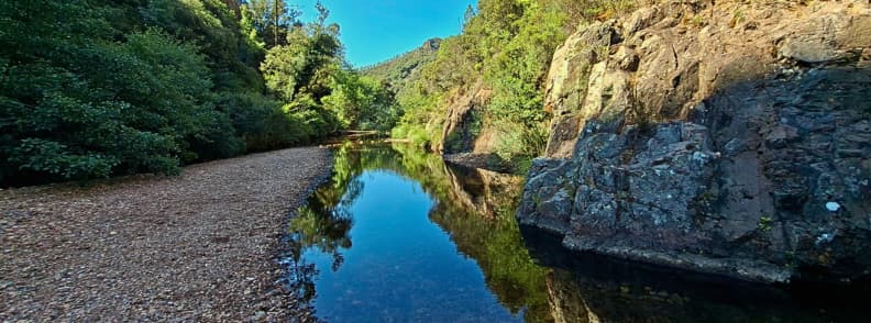
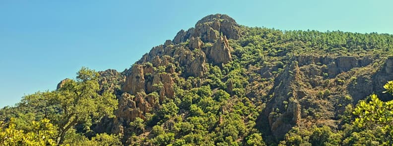
Red porphyry, pine shade, and a lily-lined pond define this Estérel Massif hiking classic. From the first steps, you’re on red volcanic rock and porphyry cliff trails, then you slip into pine forest trails and cork oak corridors before the water lily pond steals the scene. It sits right on the Saint-Raphaël hikes network, close to Agay. This trail earns its place among standout Var hiking trails for variety, color, and easy access, without sacrificing that Mediterranean wild feel.
The Famous Red Porphyry Rocks
The Estérel porphyry sets the tone from the first steps. The path rides low ridges and porphyry cliff trails where the stone glows in the sun and keeps a warm hue in the shade.
Footing is classic for a hike in Estérel Massif with red rocks. There are small marbles over a firm base, and you’ll get better traction in real hiking shoes than trainers.
If you like geology-forward Provence mountain trails or you are hiking near Cannes and want something short with character, this is a smart pick.
Mediterranean Forest Ecosystem
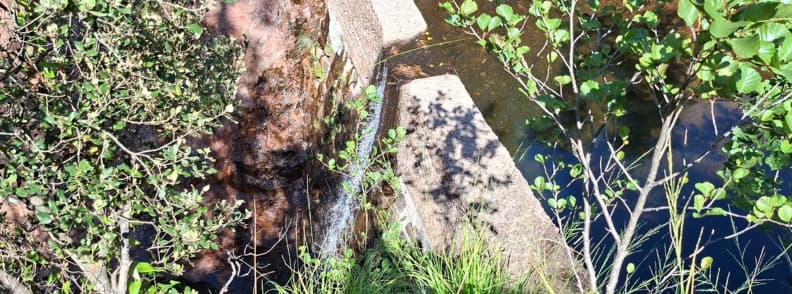
Pine forest and cork oak hold the shade through the ravine. The Ravin du Gratadis path blue markers follow a cool corridor where pines filter light and cork oaks frame the stream. Two old fountains sit above the bed, and a small waterfall appears when the flow returns after rain.
In spring, the slope to the pass carries asphodels, the clean white bloom that signals the season of spring flowers on French Riviera hiking trails (March-April). Near the start and finish, the eucalyptus adds scent and soft color, a gentle reset before you rejoin the coast.
If you want more water and forest, Lac du Grenouillet and nearby valleys offer the same pine forest waterfall hiking trails in the Var.
Wildlife Spotting Opportunities
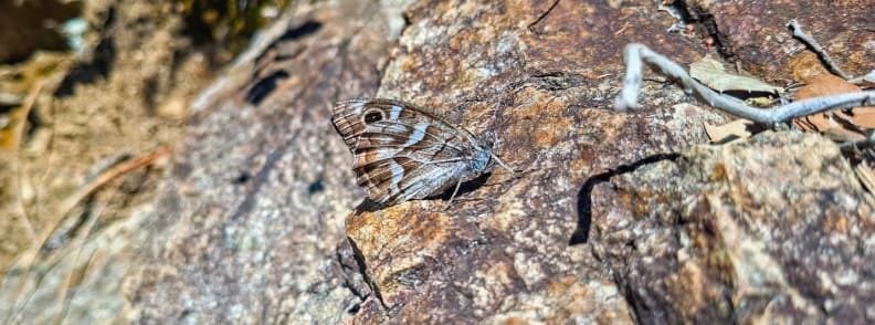
Expect small, bright encounters around the pond and stream. Dragonflies hover over the pads, butterflies in varied colors work the edges, and lizards flash across warm stone into the bushes. The lily shore rewards quiet steps and low angles, perfect if you came for a water lily pond Estérel scene rather than speed.
For families and dog-friendly hikes Estérel Massif, the shaded ravine keeps temperatures reasonable while you point out tracks and birds to curious kids who wonder what to see on hike near Saint-Raphaël beyond the red rock.
Wildlife note. I came across wolf scat on the trail, a short, ropey pile packed with coarse hair from prey the animal had eaten. Wolves do roam the wider Provençal ranges and occasionally pass through the Estérel, though sightings are rare. More typical mammals here include wild boar, roe deer, red fox, European badger, rabbits and hares, with stone martens and bats active at dusk around the forest edges.
Gratadis Ravine Hiking Tip: Start early for cool air and soft light on red stone, watch for spring asphodels on the climb, pause at the fountains and the little cascade, and finish with a slow walk through the eucalyptus to the car.
Hike to Étang d’Aubert Practical Information
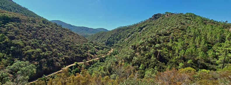
This is an easy hike Saint-Raphaël with a gentle gradient and firm footing on red porphyry gravel. Shade covers long stretches in the ravine and returns around the pond, which helps in summer. The loop suits mixed abilities on Saint-Raphaël and Agay hikes, yet still feels like real hiking on Provence mountain trails. Pack for heat, carry water, and keep the Estérel Massif map and GPX handy so you can stay on line without phone signal.
What to Pack for Hike in France
- Wear proper footwear for red gravel trails. The surface is covered with small marbles on hardpack, so low hikers or trail shoes grip better than casual trainers.
- Bring around one litre of water per adult for a short outing and more in peak heat. I carried three insulated water bottles with ice for the adults and a 250 ml bottle for our toddler.
- A brimmed hat helps when you leave the trees, and light sleeves protect on bright days. We all had hats, although I hate wearing one. So I often kept mine in the pack thanks to steady shade early, then used it on the sunny ramps near the col.
- I added bug protection in mid to late summer, even if it felt calm when we visited.
- Also, take sunscreen to protect your skin from the sun and apply as needed.
- Load the Estérel hiking GPX to your phone and download the basemap before you leave the car. Navigational tools matter.
We should have thought about taking the walking sticks, it might have made the hike even easier for Grandma. And, if we had spent more time on the trail, we would have packed the baby’s food. This time we let it in the car, protected against the heat.
If you are wondering what to wear hiking in the French Riviera, think breathable layers, grippy shoes, and a small pack with water, snacks, and a compact first-aid kit. That is what to pack for a hike in France on short Mediterranean hiking circuits like this.
Navigational Tools. Why a Map or GPS is Crucial
Waymarked trails help, but shade and rock can hide balisage when you need it most. The yellow cue after the Gué du Grenouillet is easy to miss, and the junction at Col d’Aubert can feel unclear at first glance. We’ve done both: we walked past the left turn to the metal bridge and we paused at the col until we spotted paint on a rock. Load the downloadable Estérel hiking GPX, save GPS coordinates and offline maps to your phone, and keep the map open at Col d’Aubert forks & signage. It takes seconds to confirm the Ravin du Gratadis path or the line toward Étang d’Aubert, and it turns a small doubt into a smooth, confident hike.
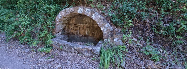
Water Sources and Facilities
Two old fountains sit above the stream in the Ravin du Gratadis. Don’t think of them as backup. They were all dried out when we passed by them in August. I carried everyone’s water and was glad I did.
I did not see any toilets near Col de Belle Barbe, so plan a quick stop in Agay before driving up if you don’t want to take cover in some bushes later on.
The pond shore has shaded banks that work for a brief picnic, although it is not a designated picnic area.
If you are searching for drinking water access Belle Barbe or toilets near trailhead, bring your own water and plan facilities in town, then enjoy your picnic spot Estérel at the pond with care.
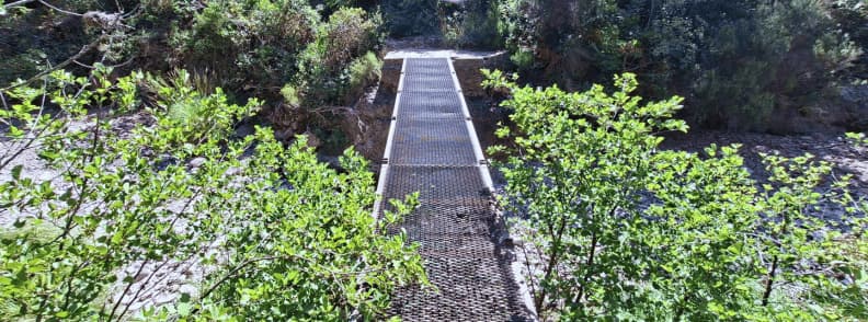
Trail Accessibility
The wide track at the start is flat and smooth, then the path narrows and becomes rocky. A short metal bridge without railings crosses the stream and can feel exposed for anyone with vertigo. My 62-year-old mother walked it at a steady pace, and our toddler rode on my husband’s back in a carrier, which is my benchmark for this loop.
I would not bring a stroller beyond the first track. Expect short ramps, uneven steps, and loose gravel near the pass.
Pet Access
This reads as a dog-friendly Estérel outing if your dog stays on a leash. The shade and stream corridor make it more comfortable on warm days. Don’t forget to bring water for pets, and keep a distance from wildlife. A leash also protects the lilies and keeps the experience calm for other walkers who came for quiet photos.
Safety Tips and Emergency Information
Treat the pond as no-swim. Most of the surface carries pads in season, and I saw a whitish film on the far bank that did not look inviting.
We had no mosquitoes on our day, although late summer can bring them, which is why I list bug repellent in the pack. Also, don’t forget to apply sunscreen to protect your skin on the hike.
The route stays shaded early, which helps in the heat, but plan start times around the daily risk map and keep a simple pace plan. If you step off the line, stop and check the GPX rather than pushing on.
In peak summer, swap to the coast if the fire risk level rises and return when conditions soften. This keeps your short hike in Estérel Massif safe and enjoyable.
In case of emergency, call 112 from your mobile. In France you can also reach the fire and rescue service on 18. Give the operator your GPS coordinates from the offline map or the Estérel GPX, state you are on the Ravin du Gratadis or Col d’Aubert section near Col de Belle Barbe, and describe the issue. If signal is weak, move to a clearer spot and try again, then stay put where it is safe and visible.
Trail Emergency Advice: If you’re hiking in a group, keep any injured person shaded, ration water, and send the most capable walker to the nearest junction only if it is close and safe. When help is on the way, conserve your phone battery and keep the line open.
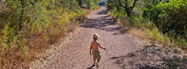
Enjoy an Easy Hike with Kids Estérel Massif
If you’re hunting a family hike Estérel that feels real yet manageable, this loop is the sweet spot. Shade in the ravine, red rock drama, and the lily pond make it an easy hike with kids Estérel Massif that still delivers wow. It sits close to Agay on the Saint-Raphaël hikes network, so you can pair it with beach time or a walk on the coastal path Saint-Raphaël after.
Is This Hike Suitable for Children?
We did it with a toddler in a carrier and my 62-year-old mother at a steady pace. We also met a mom with two boys near the col, probably six and nine. My take: from about six years kids can comfortably walk the loop, especially the shaded approach in the Ravin du Gratadis. Heat is the main variable on Provence mountain trails, so start early, carry water, and use the GPX to keep the day smooth.
For families asking about stroller friendly Agay hikes, the wide start from Col de Belle Barbe works for a sturdy stroller as a short out-and-back, then I’d turn around at the ford.
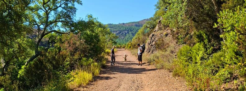
Alternative Shorter Routes
If little legs want a taste rather than the full circular hiking route, walk the easy track from Belle Barbe to the Gué du Grenouillet and return. Another option is to follow the yellow waymarks a short way into the ravine for the cool forest feel, then head back before the climb. Confident walkers can skip the pass and make a focused visit to the lily shore, using the GPX to time a neat out-and-back on the Étang d’Aubert section. These trims keep the magic of hike with kids Estérel Massif without overcommitting on a hot day.
Educational Opportunities
This hiking loop doubles as an outdoor classroom. Kids can spot cork oak and pine forest species, learn the name porphyry for the red volcanic rock, and look for seasonal asphodels on the path toward the pass. Around the pond they can watch dragonflies and butterflies and talk about why we don’t swim among the pads.
Map skills are an easy add: hand them the phone to match the GPX line to a junction and show how navigational tools solve the classic which way now moment at Col d’Aubert. If they want more things to see on hike near Saint-Raphaël, point out the fountains and the small cascade in the ravine, then finish with a simple picnic on the shaded lake bank, packing out every wrapper.

Extending Your Visit to Saint-Raphael
Use this hike as a springboard for more French Riviera trails. The area around Agay and Saint-Raphaël is packed with Côte d’Azur hiking options, from big-view summits in the Estérel Nature Reserve to easy seaside walks. If you’re planning a weekend around Saint-Raphaël hiking trails or you’re hiking near Cannes, it’s easy to stack a second outing after the lily pond, then finish with dinner on the Corniche.
Connecting Trails in the Estérel Massif
You can stay in the red rock and keep the day on Var hiking trails or switch to sea views without moving the car far. Use an Estérel Massif map to check elevation and shade, then pick a route that matches the weather.
The Sentier du Littoral (Coastal Path), a Different Experience
For a change of scene, the coastal path Saint-Raphaël runs under red cliffs and along clear water. Parts of the section near the Les Roches Rouges Hotel can be blocked at times, which is tied to local access controls and the Loi Littoral rules that protect the shoreline. If you want a sure-thing seaside walk, start from Boulouris or Cap Dramont and follow the signed path along the Corniche d’Or route. It’s a different rhythm to the mountains, and a neat contrast to the lily pond.
Other Iconic Hikes: Cap Dramont, Mont Vinaigre & Pic de l’Ours
Cap Dramont gives you a short climb to the Rocher Saint-Barthélemy and the Île d’Or view, perfect after lunch. Mont Vinaigre is the high point of the range with wide panoramas when the air is clear. Pic de l’Ours offers a punchy summit and sweeping coast-to-Alps lines. If you want a bigger scene without a long day, combine with Cap Roux panorama hike for golden-hour views over the Corniche and the bays around Agay. All thsese hikes are strong candidates for a second day of Provence mountain trails.
Where to Stay in Saint-Raphaël
For walkers who want quick trail access, I like bases in Agay or Boulouris for quiet nights and easy mornings, and the Saint-Raphaël Valescure area for straightforward transport if you’re mixing trains with taxis. If you prefer town energy, stay near the train station in Saint-Raphaël and ride out to Agay for the hikes.
If you want low-budget stays with excellent ratings and easy access to the sea, center, and hikes, these four picks hit the sweet spot:
- Le Relais d’Agay (Agay, 3★) is right across from the sandy beach and a 4-minute walk to Agay station. Perfect base for Belle Barbe and Agay hikes, with shops and cafés on the doorstep. Strong location and value, plus beach-friendly perks like towels.
- Hotel Le Virevent (Le Dramont/Boulouris, 3★) is on a quiet street, just a short walk to Camp Long and Le Dramont station. It’s the ideal place to stay in Saint-Raphaël for hikes to Cap Dramont or Pic de l’Ours, and coastal path days. Consistently high guest ratings for cleanliness and value.
- Hotel Le 21 (Saint-Raphaël center, 2★) is one minute from Saint-Raphaël-Valescure station and about 200 meters to the beach. It has simple and comfortable rooms in the heart of the restaurant and ferry zone. Great if you’ll use trains or boats.
- Hotel Provençal (Saint-Raphaël old port area, 3★) is a few steps from the harbor, ~50 m to the beach and ~300 m to the station. It’s a reliable budget choice with very good guest reviews and an easy walk to sea shuttles.

Other Attractions Nearby
Off the trail, Saint-Raphaël and Fréjus keep you busy. Families can spend a morning at the Base Nature in Fréjus, then plan French Riviera day trips from Nice when they want museums, markets, or a ferry to the Lérins Islands. If you’re building a two-day plan, a red-rock summit in the morning and a stroll along the coastal path with red rocks in the evening is hard to beat. This approach keeps the focus on nature while giving you a clear set of options for St Raphaël tourism without crowding the day.
As an example, we continued our day with a stop at the annual Polynesian Festival at the Base Nature, Fréjus. We hoped to get lunch there, but we were out of luck: they only had one food stand with a huge line, and we had a hungry, sleepy toddler with no patience.

Local Insider Tips & Trail Etiquette
This circular hiking route rewards timing, calm steps, and light gear choices. It’s short, scenic, and close to the sea, with little tricks that make your day smoother on these Provence mountain trails.
Best Photography Spots
For lilies, the time of day best for water lily photography is morning. The pads sit in clean reflection before the wind picks up, and the red volcanic rock adds warmth without blowing highlights. I like the terraced bank on the near shore and a slightly higher angle from the spur above the pond, both frame flowers against pine shade.
Late morning can still work here thanks to breeze near Col d’Aubert and pockets of shade in the ravine. If you chase color elsewhere, the porphyry cliff trails around Agay and the view lines above Grenouillet Lake add simple textures for tight shots. Bring a light cap to manage glare and keep your Map and GPS open so you can slide to the next angle without fuss.
Avoiding the Crowds
Start early from Col de Belle Barbe and you’ll have the water lily pond Estérel mostly to yourself. Weekdays beat weekends on these Var hiking trails, and shoulder months outside peak holidays feel quieter. If heat builds or the risk level rises, switch plans and finish with sea air on the coastal path Saint-Raphaël.
We’ve had good luck arriving late morning too, because the shaded Ravin du Gratadis keeps temperatures reasonable, but I still planned plenty of water and an easy pace. If the pond is busy, step back, slow down, and use the trees for framing rather than edging into the lilies.
Local Regulations and Etiquette
There is no swimming at Étang d’Aubert. Most of the surface is lily cover and, on my day, a whitish film sat on the far bank. It’s a place for photos and quiet, not for entry. Keep picnics small and discreet on the shaded bank, pack out every scrap, and don’t step into the pads.
Four-legged companions stay leashed on these dog-friendly hikes Estérel Massif so wildlife and other walkers can enjoy the pond.
Stay on waymarked trails and respect any Trail closure Estérel notices tied to fire danger. A strong wind can close access quickly, so check the daily map before you go if you’re weighing the best time to hike Estérel Massif.
One last note for comfort and safety: the metal bridge in the ravine has no railings and can feel airy for anyone with vertigo. Pause, focus on footing, and cross in a single calm move.
Estérel Massif Hiking FAQs
Straight answers to the questions hikers ask most about this loop on the Saint-Raphaël hiking trails. Quick guidance on bloom timing, distance, access, kids and dogs, safety and closures, with notes from my own track and what I saw on the day.
When is the best time to see water lilies in bloom? / When do water lilies bloom?
Late spring through summer. Pink water lilies are most reliable from July to September; you’ll still see pads and early blooms in June. Aim for morning light for calm water and fewer insects. That’s the window I use when planning a hike to see water lilies Estérel.
How long is the hike to Étang d’Aubert? / How long is the circular trail from Belle Barbe?
Officially 3.8 km, ~1.5 hours on the circular trail from Belle Barbe. In practice many hikers record 4.5-5.0 km and 1.5-2.5 hours, often due to photo stops, shade-hidden junctions, and small detours at the ford or the pass. My track read 4.89 km because I missed the left after the Gué and let our toddler set the pace.
What is the difficulty of Col d’Aubert hike?
Easy, with a note. Red porphyry “marbles” over firm ground reward real shoes, and the short metal bridge without railings can feel sharp for anyone with vertigo. After rain, sections in the Mal Infernet Ravine and the Baladou stream line can turn slick. Proper footwear keeps this squarely easy.
Where to park for Ravin du Gratadis? How to reach Col de Belle Barbe car park?
From Agay, follow signs for Massif de l’Esterel to Route du Gratadis and continue to Col de Belle Barbe. Parking is free before the barrier. Use GPS for Col de Belle Barbe parking and load the GPX so you’re set the moment you step out.
Is the Col Aubert hike suitable for children?
Yes, with judgment. I walked it with a toddler in a carrier and my 62-year-old mother. I’d suggest ~6 years to walk sections comfortably, especially the shaded approach, and older for the full loop. Factor heat and footing, and brief nervous hikers before the no-rail metal bridge.
How long does the hike take with children?
Plan ~2 hours moving time and up to 2.5 hours with pauses. Shade keeps the first half friendly, even late morning, but water and snacks still set the pace. Use the GPX to avoid backtracking at the ford and the pass.
Are dogs allowed on the Col Aubert trail?
Yes, dogs on leash. Keep pets out of the lily edges, carry water, and respect other walkers who are there for quiet photos. Leashes are also the simplest way to protect wildlife along these Var hiking trails.
Can you swim in Étang d’Aubert?
No, there is no swimming in Étang d’Aubert. It’s a fragile lily habitat and, on my visit, a whitish surface film on the far bank made it unappealing anyway. Enjoy the flowers from the shaded bank, keep picnics discreet, and pack out every scrap.
Are there other hikes near Col d’Aubert?
Plenty. For big views, Cap Roux is a short and panoramic classic, Mont Vinaigre is the high point when air is clear, and Pic de l’Ours brings a punchy ridge. They’re ideal if you want to extend Provence mountain trails or are hiking near Cannes and want variety after the lily pond.
Is the Sentier du Littoral path near Saint-Raphaël always accessible?
Not always. Sections near Les Roches Rouges can be blocked. That’s linked to shoreline protection under the Loi Littoral and local safety. Start from Boulouris or Cap Dramont if you want a sure seaside segment on the coastal path Saint-Raphaël, then loop back by train.
Is the Estérel Massif closed in summer?
Sometimes, yes. Summer access depends on daily fire risk. Check the official Var map after 18:00 the day before you hike, and again the morning of your outing. For emergencies, call 112 or 18.
What to do if the massif is closed?
Pivot to sea or town. Walk the coastal path with red rocks between Boulouris and Le Dramont, visit the old port and beaches in town, or plan museum time and French Riviera day trips from Nice. Recheck the Estérel Massif status that evening and switch back to the lily loop when conditions ease.
What can you see on the Gratadis Ravine hike?
A tight mix of cork oak forest, pine forest trails, and red volcanic rock with a lily pond finish. In spring, look for asphodels on the climb. Around water, you may spot amphibians, lizards on warm stone, huge dragonflies, and a flutter of butterflies. Eucalyptus lines the last stretch back to the car.
Is Étang d’Aubert & Col d’Aubert Your Next Riviera Hike?
If you want a short, scenic loop on the Saint-Raphaël hiking trails that still feels wild, this is it. Red porphyry underfoot, cool forest in the Ravin du Gratadis, a breezy stop at Col d’Aubert, then a quiet shore lined with pink water lilies. It’s classic Mediterranean hiking in the heart of the Estérel, close to Agay and easy to fold into a day of beach time or a stroll on the coastal path Saint-Raphaël.
It suits families, first-time visitors, and anyone building a compact plan around Provence mountain trails. The gradient is friendly, the footing is manageable in real shoes, and shade carries much of the approach. Photographers get clean morning light on the pond during bloom, and hikers who like variety get forest, rock, and water in one pass. If you’re hiking near Cannes, it’s an effortless add to a weekend.
Bring a small pack and think simple: shoes with grip for the hike in Estérel Massif with red rocks, a hat and water, and the GPX on your phone. Keep dogs on a leash, picnic lightly on the bank, and treat the pond as no-swim. If summer fire risk Estérel closes access, pivot to the sea, then come back on a safer day. That’s how you keep this compact loop enjoyable while respecting the massif.
If you have more time, link it to the Cap Roux panorama or go higher on Pic de l’Ours or Mont Vinaigre. Use the Estérel Massif map here to pick by heat and wind, or switch gears with a coastal segment. For me, this route is the cleanest answer to what to see on a hike near Saint-Raphaël in a single morning: a real sense of the Estérel, lily bloom in season, and zero fuss getting back to the sea.
About the Author

I’m Mirela Letailleur, the writer behind The Travel Bunny and a local who walks the Saint-Raphaël hiking trails week in, week out. I map routes on the Côte d’Azur and in Provence, test them with my family, and turn them into clear, budget-friendly guides in English, French, and Romanian.
I care about practical details and safety. You’ll see season notes for Mediterranean flora, fire-risk checks for the Estérel Massif, gear tips for red-gravel footing, and family advice drawn from hiking with our toddler. I cover Var hiking trails and Provence mountain trails with one aim: to help you enjoy smart Mediterranean hiking with local context.
For more Provence hiking trails tips, check out these guides on The Travel Bunny
Provence in Spring, a Comprehensive Local Travel Guide
Provence Weekend in Carcès: Village, Caramy Falls Hike & Thoronet Abbey
Bagnols-en-Forêt: Discovering the Hidden Charm of Provence

