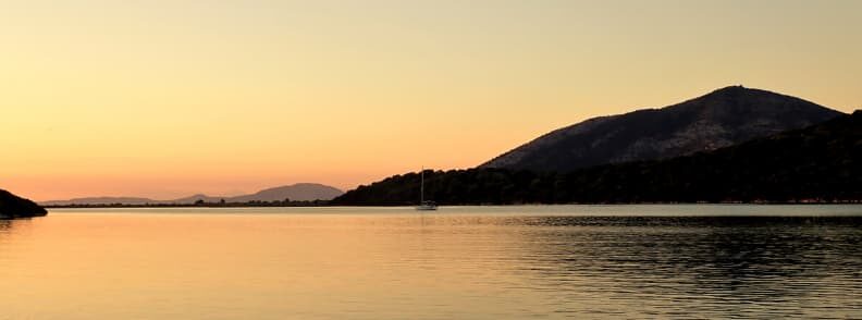
In 2020, my husband and I were lucky enough to go sailing the Ionian Islands for several weeks. We saw all the big islands but still haven’t covered everything. And, before writing about the experience in detail, in this travel blog article from The Travel Bunny, I’ll be sharing just a few details I’ve learned while doing research for our expedition at sea. But first things first!
The Odyssey
No guide to sailing the Ionian Sea in Greece can be complete without the mention of Homer and the Odyssey.
The Odyssey relates the tale of Odysseus and his journeys and adventures in the Mediterranean around 800 BC.
The Trojan War ended when the Greeks succeeded in bringing a wooden horse into the city of Troy. The Greek soldiers were concealed within it and opened the gates of the city to the Greek army that then sacked the city. Odysseus and the other Greeks should have learned how to return to their realms across the sea. To say that the journey of Odysseus was eventful is rather an understatement.
He sails south through the Aegean Sea as he departs from Troy in what is now northwest Turkey. Upon hitting the southern tip of Greece, the lotus-eaters are blown off course in what is believed to be Libya.
It’s then to Sicily where he’s going to run into Cyclops. This eye-catching giant eats two members of the crew before they flee. More trouble with the Laestrygonians in Corsica or Sardinia. Here, the fleet is struck by giants hurling boulders, and more crews are devoured. The survivors travel east to Italy and the enchanting Circus. She entertains the sailors and then, with a wave of her wand, transforms them into pigs. Odysseus is covered by the herb given to him by the god Hermes.
Reference is made to the pillars of Hercules at some stage in the journey. And this is meant to be the Rock of Gibraltar and the Jebel Musa of Morocco. These two mountains are located on either side of the straight line, which is the entrance to the Mediterranean Sea from the Atlantic Ocean.
Now he must pass over the Sirens whose sweet singing lures sailors to their deaths. Odysseus’s plugs fill his crew’s ears with wax, and then he clashes to the mast so that he can’t guide the ship onto the waiting rocks.
Passing across the straits between Sicily and mainland Italy, they run into Charybdis, who swallows the water in a whirlpool, and then spits it out again. And Scylla, who uses each of her six hands to get down from her cliff and get a sailor out of the deck. And, yes, you guessed, she then eats them.
More bad luck comes upon them as they upset the god Zeus, who sends a thunderbolt to kill the boats. Only Odysseus survives, washed ashore in Malta, the den of the nymph Calypsos. She detains him against his will. Zeus, King of the Gods, sends Hermes over the waves on enchanted sandals with instructions for the liberation of Odysseus. But when another god, Poseidon, sends a storm to kill his vessel. A few days later, he is washed ashore on Corfu. He falls asleep in an olive grove and is awakened to the sound of a woman’s laugh. This is the princess Nausicaa who comes down to the riverside to wash her wedding dress.
Odysseus pursues her, and she decides to help him finish his journey home, sailing the Ionian. She introduces him to her father, and when he hears the tale of Odysseus, he orders him to go home to Ithaca.
Once home, he finds the island full of suitors wanting to wed his wife, because Odysseus was presumed dead. He and an ally fight and win a war against all odds (with a little support from the gods). And then Athena tells the contending parties to live together in harmony for years to come.
Disclosure: Some of the links below are affiliate links. This means that at no extra cost to you, The Travel Bunny will earn a small commission if you click through and make a purchase. Thank you!
Keep an eye on the weather when sailing in the Ionian Sea
The wind is consistent with the conditions in the eastern Mediterranean. No wind in the morning, but as of midday, the wind freshens up to 20 knots in the afternoon. The night and the night sees a return to peaceful conditions. It blows from the NW and the SW for the remaining months during the summer months.
I advise you to check your weather apps and listen to the radio for weather warnings at least on a daily basis. This year we got caught by a medicane, which is a Mediterranean hurricane. Although we ran far enough to be caught only by the edge of medicane Ianos, others weren’t so lucky: 43 boats sank in just 48 hours.

Sailing the Ionian Islands: Northern Ionian Sea
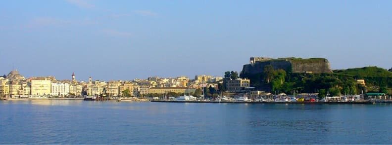
Corfu or Kerkyra
The island of Corfu receives three times the average amount of rain for the region, resulting in a mass of green forests, wild pine-covered mountains, lakes and cultivated fields. It also has miles of sandy beaches.
The largest port is in the island’s capital, Corfu Town, providing probably the finest all-around facilities you’ll find while sailing the Ionian Islands. Enter the Old Harbor from the east end of the breakwater. The entrance to get inside the port is very narrow, and a powerful northwesterly makes it difficult to reach. Once inside, it provides excellent shelter in all kinds of weather.
Visitor’s berths are at the side of the windward jetty, two and three meters deep. The greatest part is that you’ll be berthed within walking distance of the city center. Chandlers, machine shops, boat engine repair facilities and others for electrical and electronic gear can be found near the harbor.
Anchoring isn’t recommended in this area, you’re almost certain to get your anchor/chain caught or tangled.
- Visit Sidari in the north of Corfu to swim in the Canal d’Amour during your sailing holidays. The legend says that lovers will remain together for a lifetime if they hold hands while swimming through this small tunnel.
- The Achilleion, built in the Italian Renaissance style at 145m above sea level, is located 16 km south of Corfu Town. It has beautiful gardens and wonderful panoramic views. Today, it is a museum open to the public.
- Another 3km south of Corfu Town is the charming fishing village of Benitses and the ruins of a Roman villa.
- Climb to the top of Mount Pantokrator, where you can find an abandoned monastery dating back to 1347. The hilltop also offers stunning views over the island and the Ionian Sea.
Gouvia is a large landlocked bay, is just 3 miles to the NW. At its southern end is Gouvia Marina, which has become the main hub of Corfu’s yachting. It is also home to the Venetian arsenal. The surrounding area has been given over to the package holiday and there are more fun places to spend time on a yachting holiday.
The North Corfu Channel is a stretch of water between Corfu and Albania.
Beware of the reef just north of Agios Stefanos when sailing the Ionian in this area!

Agios Stefanos is a small inlet on the North Corfu Channel. Normally, there is no reason not to anchor here, although there is a military post nearby. Just make sure to anchor in the center of the harbor, 3-6m deep. The bottom is a dense mixture of weed and mud that can be difficult to get through, but once you get settled here, you’ll find shelter from the prevailing wind of the NW. There’s a rough stone mole on the south side of the bay, but it’s usually taken by local vessels.
There are several tavernas and some holiday villas along the coast, but the bay is still peaceful and stunning, well-worth a stop for the night. You can even go shopping for some provisions, though your options will be pretty limited.
Agni Bay is located immediately south of Kalami, in the northeast of the island. It is open to the south and east but offers good shelter from the prevailing NW wind.
In Agni Bay, there are three taverns, and each taverna has its private jetty, where you can anchor bow-to. If you’re there for the night, it’s best to anchor at the northern or southern end of the bay to avoid the huge waves made by ferries entering and leaving the bay during the night.
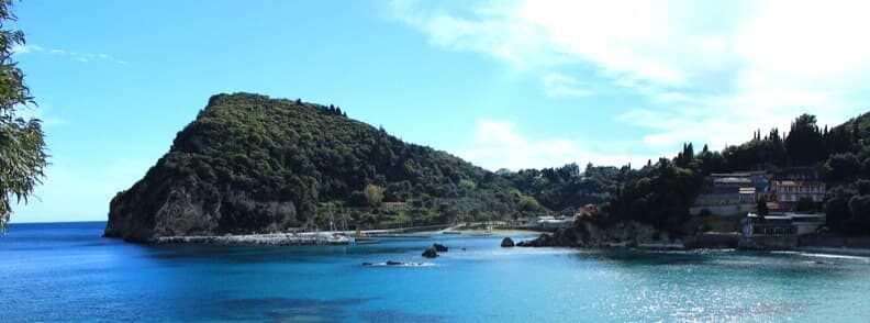
Paleokastritsa is on the east side of the island. It is an enticing tourist resort dominated by the Monastery of Panayia Theotokos, perched on a high cliff. A 90-minute climb takes you to the ruins of Angelokastro Castle, dating back to the 13th century. Several sea caves in the area can be reached with the tender or just by swimming.
By day, it’s not easy, to tell the entrance to the bay from the northwest. The monastery on the top of the peninsula is nevertheless conspicuous.
The harbor is located on the western side of the bay and is protected by a quay that spreads from the north to the south. Typically full of fishing caiques, only a few available berths can be found near the head of the quay. Safety is good in all conditions except for extreme southerlies when waves crash over the breakwater and create a wide swell in the harbor.
There’s no water in the harbor but there are pubs, restaurants, and a supermarket within walking distance. Fuel can be shipped to you while you’re in the harbor of Paleokastritsa.
Petriti Village. The old quarry is visible from a distance to the north of the harbor. Shallows are stretching south of the harbor along the river, and caution is required. But, as it offers good protection from all weather conditions, it’s worth the trouble. Just head for the new quay near the land, where the depths are greater than 2 meters. If you moor behind the breakwater, be aware of the shallow waters near it.
The taverns on the shore typically have fresh fish. Shops can be found in the village of Argyrades, about three kilometers away. Nice beaches for swimming in the vicinity.
Paxos & Antipaxos
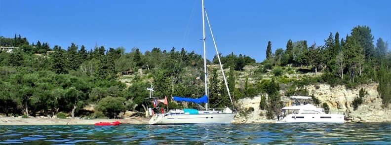
If you continue sailing the Ionian Islands heading south, you’ll soon reach Paxos (Paxoi), a charming little island, dotted with pine trees. This Greek Ionian Island is just 7 miles south of Corfu. It can be thoroughly explored in a couple of days with a car or a motorbike, all of which can be rented locally. The architecture of the three major cities, Gaios, Lakka, and Logos, is traditionally Ionian, with colorful two and three-story houses lining the streets. On the other side, the rural landscape is packed with low-stone houses surrounded by lush green gardens.
The sign of Paxos is the Trident. It is said that Poseidon, the god of the seas, wanted to build a lovely, peaceful island apart from the other gods and men and to live there with his beloved Amfitriti. So he hit hard his trident to the southern part of Corfu, and Paxos was created. However, he lost his trident while casting this blow and it was later found by the Paxiots, who made it their symbol.
Gaios is the capital city of Paxos Island. It’s a charming little port that stretches along the coastline. Reach Gaios from the north, passing by two small islands: Panayia and St. Nicholas Island. (If your draft is small, you can safely approach Gaios from the south side of the channel, too.) The port of Gaios and the approaching inlet are very secure for overnight moorings in almost all weather conditions. Care should be taken when you position your anchor, as passing ferries in the narrow canal can foul your chain.
Port Gaios is actually the largest port of Paxos. You can moor right in the middle of the busy tourist scenery or pick a quieter berth further down the long quay. If you want to find a spot here in July or August, be here early in the afternoon. However, if you’re there only for one night, you can also arrive at 17.00 and go to one of the empty ferry spots. Just make sure you leave before 10.00 when the ferries begin to arrive the next day.
Soak up the atmosphere of this busy city in Gaios Square, with the Church of St. Apostoli in the middle. There are many other beautiful buildings worth visiting: the castle of St. Nicholas, the Monastery of Panayia, the church of Agioi Apostoli, and the early Christian church of Agia Marina. Watch the sunset at the Ostries and enjoy the fine beaches of Ioni Gouli, Kamini, and Kaki Lagada.
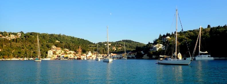
Lakka, in the north of Paxos, is set in a gorgeous horseshoe-shaped bay, flanked by a high ground filled with cypress trees and olive groves. The bay, almost landlocked, is excellent for swimming and water sports.
Holding is very good here, thanks to the sandy bottom. Some swells can occur depending on the direction of the wind. There are a few berths on the quay, restricted to around 10 sailing yachts. Freshwater can be bought from a water truck.
Just south of Paxos, you’ll find, Antipaxos, its tiny sister-island. Antipaxos is surrounded by crystal clear waters that leap onto some lovely sandy beaches. While it is more attractive because it’s wilder than the other Ionian Islands, its bays offer less protection and there aren’t any harbours.
Sailing the Ionian Islands: Southern Ionian Sea
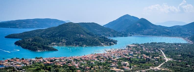
Levkas or Lefkada
The first of the southern Ionian islands, Levkas is a popular, vibrant, and windy island. It is the only island connected to mainland Greece by a swing bridge offering road access. The Preveza airport is just a 30-minute drive.
Lefkas Town lies a short distance down the canal, at the point where the canal turns to SE. The buildings of the city are easily seen and the harbor is not at all difficult to find. There’s an expensive marina here, or you can use the cheap public quay of the area. Both offer good shelter in all weather conditions.
The Lefkas canal helps sailors travel along the east side of the island, which has the most anchorages. As you arrive from Corfu and Paxos, the north entrance is by the Fort of Santa Maura. The canal itself begins after the town of Lefkas and is marked by red and green poles and red and green buoys when the canal turns south.
Nidri is vibrant and the quay has water, fuel, etc. However, it places you in the center of the yacht charter bases, tripper vessels, ferries, etc. If it rained recently, I recommend a nice hike to the Nidri Waterfalls, too. (We went in the dry season and still enjoyed it, though.)
A little farther south, the landlocked Vlicho Bay offers a decent all-round shelter with good holding (mud). And, just before it, another good stop is in Tranquil Bay.
On the southern end of Lefkas Island, you’ll find the sheltered bay of Sivota, with many waterside bars and tavernas. There, you can just call ahead one of the restaurants (we recommend 12 Gods) to book a place on their piers. And, as long as you eat there, you’ll get a free spot, electricity, water, and showers. The food is amazing and fair-priced, so it’s an excellent deal. (Especially for the showers, you don’t find lots of places with showers when you’re sailing the Ionian Sea or Greece, in general.)

Vasiliki has quayside pubs, cafés and a non-stop nightlife on the southwest coast. Once a quiet fishing village, it is now one of the key resorts of the island.
In Vasiliki, you might meet Eric. Much stronger than your usual sea breeze, Eric is the wind that blows through this bay in the afternoon. While it turns Vasiliki into an amazing travel destination for surfers, it can sometimes reach speeds of 30 knots. You might want to remember this when you’re sailing the Ionian Sea.
The port is located in the south-east of the wide bay. It provides good shelter even if the prevailing wind continues to blow into the harbor, often making conditions unpleasant. The bottom offers a good holding. There are no anchorages on the west coast, but you’ll find beautiful beaches where you can watch the sunsets.
- The ancient city of Nirikos was the first capital of the island from 2BC. Excavations have shown that Nirikos experienced significant economic growth.
- The collection in the Archeological Museum of Levkas contains discoveries dating from the Proto-Hellenic period to the Roman era, including ceramics, pots, sculptures, signs, ecclesiastical works, and images from the excavations in Nidri.
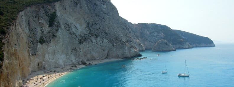
- Cape Lefkada is located in the southern part of Lefkas, offering a magnificent view. Originally, offerings were made from here to the gods and spirits. Convicts were required to leap from the rocks and try to escape with feathers wrapped around their bodies.
- The monastery of Panayia Faneromeni is the most important religious monument on the island. It is located 2 km east of the capital, outside the village of Frynio, on the site of the ancient sanctuary of Artemis or Hera.
Meganissi
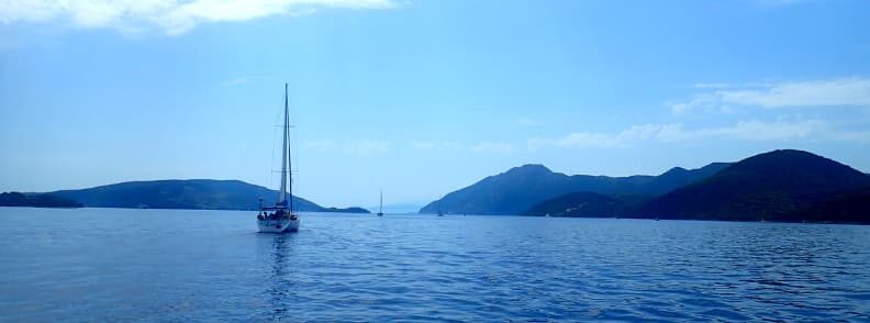
Meganissi has a beautiful inlet on the north coast of Port Athene. This is the ideal place to snorkel and swim or just stop for a good overnight rest.
Vathi is the largest port on the island. It is a nice relaxed place with good walks through the olive groves to the bays of the east.
The high village of Spartohori can be seen from the north and west. The small harbor can be seen once you’re in the bay. It offers nice shelter, but the depth is always more than 15m, so you can anchor here only with floating lines to shore. The anchorage near the tavern is the best spot in the bay.
The village of Spartahori is an absolute must. Walking up the hill for a warm local welcome and to admire the amazing view of Nidri, Madouri, and Skorpios and the mountains on the mainland to the east. The island has a variety of picturesque bays where you can anchor and take a line to shore. Facilities are minimal at best and usually non-existent.
Ithaca
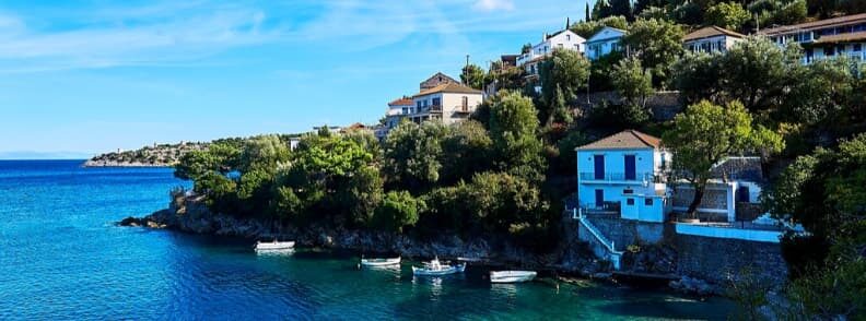
Steeped in the legend of Odysseus, the island has lovely bays and enticing anchorages. The island is basically two heavily forested mountains, rich in flora and fauna, which protrude steeply from the Ionian Sea, with a thin strip of land in the middle of the island. It provides gentle green uplands in the south and rough limestone hills in the north.
Frikes is a small Ithaki harbor, a village in the northeast of Ithaca, set in the bay from which it takes its name. It is a beautiful location at the bottom of a steep wooded gorge with some old windmills on the rocks above the village.
Kioni is just south of Frikes. The village is beautiful with its buildings scattered across the steep slopes of the bay. The bottom is covered in mud and weed, and you must set your anchor with care for a good holding. Shelter is generally good, but there are regular gusts from the north west. There are shops and tavernas on the waterfront in the village.
Even further south is Vathi, the capital of the Ithaca and its main port. In Molos Bay, where Vathi is located, the bottom is a mixture of mud and weed, so you’ll have to set your anchor carefully if you’re looking for good holding.
There are a number of shops and tavernas in the area. Three kilometers northwest lies the Cave of the Nymphs, where, according to legend, Odysseus hid the gifts bestowed upon him by the Phaeacians who had returned him to his home after his many adventures. Unfortunately, the Cave of the Nymphs has been closed for restoration works for a while now. While there are tourists trespassing through the broken gate to visit its interior, I recommend you heed the warnings of local guides and keep out.
You can, however, visit the Cave of Louizu. This one is located on the west coast, in Polis Bay, near the village of Stavros. Some interesting discoveries were made here. Archaeologists found shards with carved inscriptions testifying to the worship of Artemis, Hera, and Athena, and twelve tripods similar to those offered by the Phaeacians to Odysseus.
Cephalonia or Kefalonia
Cephalonia is the largest of the Ionian Islands, with a surface area of around 700 sq. km. It is popular for its wine and for the novel Captain Corelli’s Mandolin written by Louis de Bernieres. (By the way, this is what I’m reading these days!)
The island of Cephalonia has acres of forest-covered limestone mountains for the walker to discover. There are 10 peaks above 5000 feet. The limestone rock is the product of remarkable caves and caverns, as can be seen in the Mellisani underground lake complex. Most of the mountains fall steeply to the sea and you will be sailing the Ionian at the foot of these peaks. In some areas, this means that the boat will be exposed to strong gusts of wind so caution is required!
Fiskardo (Fiscardo) is an enclosed bay and harbor on the north-eastern tip of Cephalonia. It’s an incredibly common stop for yachts, and the quay is usually crowded in the summer months. If there is no space to anchor in the north of the harbor, take a line to shore. The harbor is excellent at providing all-around shelter.
The village is picturesque and was one of the few locations on the island that spared the terrible devastation of the earthquake of 1953. As a result, the 19th-century houses set in the center of green pine groves are pretty much the original ones, and the historic preservation order should keep them that way. In Fiskardo, you’ll also find a number of shops and some tavernas with excellent food.
There are some anchorages on the coast between Fiskardo and Agia Eufimia in the south.

Agia Eufimia is a small harbor in the northwest corner of a wide lake. Most of the provisions can be bought here, and there are a few tavernas.
Sami, in the south of the same bay, is the only ferry port of Cefalonia. It was built after the earthquake and has almost only new buildings. There are pleasant walks along the coast to the northeast of the port.
The tiny port of Poros is still further south. This is not the most comfortable harbor you’ll find while sailing the Ionian Sea, with the prevailing winds producing a chop in the harbor. It’s more uncomfortable than unsafe, but either way it will want you to shorten your stay here.
The capital of the island is the SW of Argostolion. The earthquake of 1953 brought almost complete destruction to this town, leaving untouched just a few houses, the arched bridge extending across the lagoon, and the obelisk in its middle. Unfortunately, the reconstruction has created a very soulless area, more modern-looking than other places you’ll find while sailing the Ionian Sea. You’ll find numerous shops and tavernas in the area.
Lixouri is a small harbor-town opposite Argostolion on the western side of Kolpos Argostoliou. Unfortunately, the port is located right next to the main sewage outlet and is particularly fragrant during the summer months.
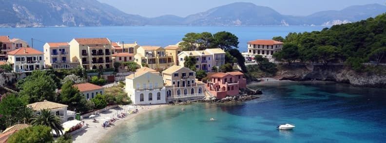
Assos, on the western side of the Cefalonia, should only be visited by boat in calm conditions or when the wind from the west is light. There are several tavernas in the village and small shops, too. The village is especially picturesque, as it is set beneath high cliffs and mountains and just across the peninsula from the ruined Venetian fort.
Zakynthos or Zante
Zakynthos is the southernmost island in the Ionian Sea. A horseshoe-shaped mountain range surrounds a lush, fertile plain. Half of the island’s cultivated land is given over to the Zante currant vines, which were originally transplanted by the Venetians from the Peloponnese.
Ormos Agios Nikolaos is in the north east of the island. You can anchor in the bay at a depth of around 5m or go stern-to outside of the breakwater with a long line to shore. Powerful gusts can be expected in the afternoon and most of the yachts leave after lunch and head south to the capital of Zakynthos.
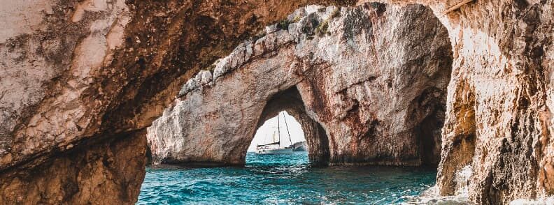
A visit to the Blue Caves is a favorite in this part of the island. Join one of the nearby caiques for a visit, as it’s not recommended to go on your sailboat or motor yacht. The area is unprotected from the northwest and the waters are too deep to anchor.
The underwater rocks are dominated by mauve-colored algae. The seaweed and the white sandy bottom of the caves reflect the incoming sunlight, which creates the blue hue that made the caves famous.
To the south lies Limin Zakynthos, the capital of Zante, where most of the island’s inhabitants live. The city is surrounded by a wide harbor. It was destroyed by the earthquake of 1953, but an effort was made to restore it in its original form. The semi-sunk stone breakwater, which protrudes from the north mole, should be avoided with care when entering the harbor.
When mooring on the public quay, do not accept the help of the marineros. They don’t work for the port and they will charge you steeply to help you with the lines. Refuse them politely, tie your boat, then head to the Port Authority of Zakynthos to pay for the berth and maybe get a card for water and electricity, too.
Porto Roma is on the south east corner of the island. It’s a beautiful anchorage in calm weather with a pub on the beach.
The southern coast and the beaches are home to the last and most significant concentration of the Loggerhead turtle nesting sites in the Mediterranean. From May to November, this area is subject to restrictions on vessel entry. It is advisable to check with the authorities in the capital of Zakynthos what restrictions are currently in place if you are planning to sail to this area.
Ormos Keri is situated at the western end of the restricted area. Anchor either side of the stone mole and take a long line to shore. Be mindful of the underwater ballasting coming out of the mole.
Ormos Vroma is the only anchorage on the west side of the island. Anchor on the north side and take a line to shore.
[Featured image shot in a well-protected bay just North of Igoumenitsa.]


Mirela Letailleur is a Romanian travel blogger living in the South of France. She writes on The Travel Bunny travel blog about affordable travel in Europe, creator of unique free travel guides, local travel expert. Problem solver. Wannabe coffee guru.
You should also read these articles on The Travel Bunny blog
Guide to sailing the Cyclades Islands in the Aegean Sea
Sailing in Croatia: 15+ destinations to see by boat
Our Bavaria 350 for sale in Greece

