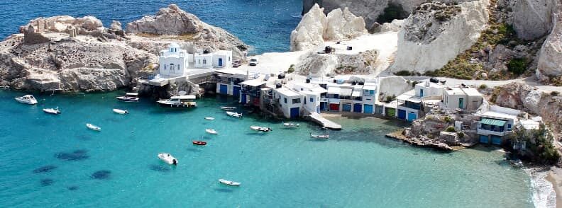
After the short guide to sailing the Ionian, it’s time for a quick guide to sailing the Cyclades Islands in the Aegean Sea. We didn’t make it further than the Saronic Gulf on our own trip because of the weather and limited time towards the end. However, we planned to get there initially, so I’ve done so much research on this subject! And I’m not one to let things go to waste, which is why I want to share what I’ve learned and help you with your planning when you go sailing the best Cyclades Islands!
Are the Cyclades windy?
Yes, they are. The wind that prevails during the summer months when you’re sailing the Cyclades is the notorious Meltemi that flows from the N-NW. It is felt for the first time in June and grows stronger through July, August, and September when it can hit force 8. It slows down in October.
Spring and autumn gales are popular in both the N and the SE of the Cyclades Islands. The summer months are humid, with average temperatures of 25°C. Temperatures frequently exceed 35°C, though.
Use Navionics to draw up the itinerary for your sailing vacation in these beautiful islands!
Sailing the northern Cyclades Islands
Kea
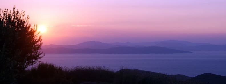
From all the Cyclades Islands, Kea is the closest to Athens (Attica region) and Rafina port. It is a rocky island with narrow valleys, and only orchards and vineyards break its coarse landscape.
The Greek island Kea is quite a vacation spot and its various bays and attractive villages provide peaceful recreation in comparison to the other more famous Cyclades Islands. Hora is the capital of the island and home to the Archeological Museum, which houses a variety of archeological discoveries from the Cycladic period, of course.
Greek mythology has it that the island of Kea is where you could find the springs of the forest nymphs that represented the “liquid element”. The gods envied its beauty and sent a fearful lion to persecute the nymphs who fled to Karistos to take cover. Because the nymphs fled, a long period of dryness began, the water levels declined and the plants dried up. The Islanders prayed for help to Aristaios (Apollo’s son). He came to the Kea and founded a sanctuary to worship the god of rain, Ikmaios Zeus. The gods were finally at peace and the draught went away, letting local agriculture prosper again.
Coressia is the port of Kea and it is located in the northwest of the island. The harbor houses are constructed around the bay, on a narrow plain. You should moor stern or bow-to the quay, staying clear of the ferry berth. As the Meltemi blows straight onto the quay, make sure your anchor’s holding well.
Vourkari, further NW in the bay, also has a quay where you can moor stern or bow-to. There are also other potential places to anchor in the bay if the weather is calm. Fuel is available in Coressia and shops and tavernas can be found in both Coressia and Vourkari.
During the summer months, the bay is more often than not crowded with yachts from neighboring Athens. You’ll find them mostly in Vourkari, with the sailors out to enjoy the picturesque town by day and the nightlife after sunset.
Ioulis, the capital of Kea, is around 5.5 km from Coressia. Most of the old mansions were raised next to the abandoned castle. The ancient acropolis of Ioulis and the magnificent sculpture of the Lion of Kea are both well worth a visit, as are the churches of Panagia Gamila and Panagia Revmatiani and the abandoned monasteries of Agia Anna and Dafni.
There is an anchorage on the coast further south at Ormos Pisses, but there are no services here. However, it’s next to a beautiful beach — Paralia Pisses.
Further south, the anchorage of Ormos Kavia near Koundouraki Beach is now accessible just to the south, offering a strong refuge from the Meltemi. At the taverna, you’ll find food, electricity, water, ice, and showers.
Ormos Polais is situated in the SE of the island. This anchorage offers some protection from the Meltemi, but it’s not always a comfortable stop. There are ruins on the shore, including those of the mosque.
Khalidhoniki is a small cove in the north of the island with a strong shelter from the Meltemi. A little settlement on the coast has a pub.
Otzias is a small cove on the northern shore, which can only be used to anchor in calm weather. There are no services there.
What to see on Kea while sailing the Cyclades Islands
- Lion of Kea. This massive stone lion head is carved into a rock and dates back to the prehistoric period. This lion, which can be located a short distance from Ioulis, is connected to many island legends and customs.
- Archeologiko Mousio Keas. The Archaeological Museum is near the Ioulis Castle. It houses artifacts discovered during excavations on the island, including those from Ancient Karthea and the prehistoric settlement of Agia Irini.
- The Church of St. Anna (Agia Anna) is on a hill above Ioulis. It played an important role in the development of the Kea in the past.
- Panagia Kastriani. This monastery is situated 7 kilometers east of Otzias in a remote area. On top of a rock above the sea, it’s Kea’s most prominent religious establishment.
- Monastery Agia Marina. In the island’s center, the church of Agia Marina stands next to a destroyed Byzantine wall. It used to be the katholicon (main church) of a 17th-century monastery.
The best beaches on Kea Island
- Paralia Gialiskári
- Xyla Beach
- Spathi Beach
- Koundouraki Beach.
Kythnos
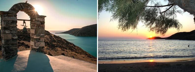
The desolate, rocky island of Kythnos is only 6 miles south of Kea, so it’s easy to make a stop when you’re sailing the Cyclades Islands. Legend has it that the Dryops from Eboea, had settled in Kythnos in the 11th century BC. In classical times, the island was a well-organized city-state admired by Aristotle.
Excavations have discovered a site that dates back to the Neolithic or even the Mesolithic period, making it the oldest dwelling in the Cyclades. More recently, around 200 BC, the island was also targeted by the Romans, but they have never succeeded in capturing it.
Kythnos is 19 km long and occupies an area of 80 sqkm. A large number of fig trees are the only green shade in the heat of the season. Today, the island is popular with locals because of the many thermal spas located in the northeast of the island.
The capital of the island stands inland on a hillside plateau. It’s a traditional Cycladic village with lovely churches featuring fine wood carvings, sanctuary screens, and icons.
The bays of Apokriosis and Fikiadha lay on the western shore. Anchor in one of them when you’re sailing in the Cyclades Islands and you’ll find shelter with a good holding in an attractive setting. There are also some nice white sandy beaches here, but no facilities.
The island’s port Merika sits farther south. Moor stern or bow to along the quay inside the ferry berth. Near the SW end of the quay, the water is shallow, so a bow to approach is recommended. Fuel can be bought from a truck. You’ll find almost anything you need to replenish your supplies in the village, and there are also some waterfront tavernas.
The anchorages of Kanala and Agios Nikolaos can be located on the south-east of the island, but I recommend stopping here only in calm conditions. There aren’t any facilities available here.
The anchorages of Agios Stefanos and Ioannis are farther north on the east coast of Kythnos. They provide good shelter from the Meltemi, but in some areas the holding is bad. There is minimal water supply available at Agios Stefanos, but no other services.
The village of Loutra is located in the north of Kythnos Island. Approach the quay bow or stern-to. Freshwater is available on the quay and you can find almost anything in Loutra’s shops. You’ll also find some tavernas here.
What to see on Kythnos while sailing the Cyclades Islands
- Katafiki Cave. This cave is an exception to the island’s elegance, which is mainly seen above ground. It is absolutely breathtaking, according to guests, and well worth a visit!
- Loutra Hot Springs. People travel from all over the world to enjoy the springs on Kythnos every year. The baths are not only warm and welcoming, but they are also in a lovely setting.
The best beaches on Kythnos Island
- Kolona Beach.
- Paralia Martinakia. While it is possible to swim in the center of nearby town, it is preferable to walk 10 minutes north to this lovely little cove.
Serifos
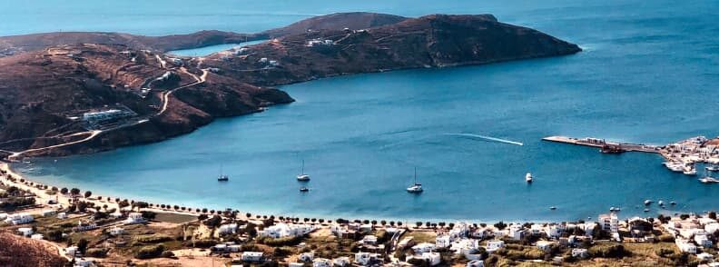
Serifos is a barren, rocky spot in the Cyclades Islands that is home to many abandoned mines. Tourism has resurrected the island’s fortunes.
The only harbor on the island is Livadi. Go stern to the quay’s south side or anchor off. Despite the heavy gusts of wind, there is good shelter from the Meltemi. However, there is a significant swell into the bay because of the powerful southeast wind. Normally, this area is very crowded and noisy. You can also go stern to the northern side of the quay, but avoid this in heavy northerlies or risk weak holding.
Concrete piers enclosing a small harbor with mooring lines were installed in 2015. A larger boat can also go stern to on this pier.
Bring mosquito protection if you plan to stay in Livadi for the night. We installed mosquito nets and also used spirals to deter them from the cockpit at night.
Koutala Bay is a wide bay on the south side of Serifos Island. While it offers strong protection from the Meltemi, it’s vulnerable to extremely violent katabatic winds. Be warned that they can range from 0 to 25 knots in a matter of seconds, so you might want to drop two anchors.
Megalo Livadi is an inlet just north-west of Cape Kyklops. The shelter here is adequate, but the surroundings are desolate, so unless you plan to hike, it’s not really worth a stop when you’re sailing in the Cyclades Islands.
What to see on Serifos while sailing the Cyclades Islands
- Serifos Mining Trail by Megalo Livadi Bay. Follow the natural seaside path from Megalo Livadi to see these rusted out mining ruins set against a backdrop of green fields and sloping hills covered in wildflowers. The route will eventually lead to the island’s real mining caves and some warm water springs. Don’t explore the caves without a guide, because they’re unmarked and it’s easy to get lost!
- The Cyclops. The Cave of Koutalas, also known as the Cave of the Cyclops, is situated on the southwestern coast of Serifos Island, just west of Koutalas Beach.
- Throne of the Cyclops. Serifos was the setting for exciting adventures with Perseus, Medusa ), and the one-eyed Cyclops in Greek mythology. From the Cyclops Cape, go up to the Cyclops Throne and feel like the king or queen of the Cyclades Islands! The locals named it Psaropyrgos, and it was built out of several large rocks in the shape of a massive chair.
- Church Agios Konstantinos.
The best beaches on Serifos Island
- Paralia Psili Ammos is a Blue Flag beach with soft powder sand in a shallow turquoise cove.
- Ganema Beach. When strong winds blow, this beach offers some protection. The water is clear and has a green tint to it. You’ll find a traditional taverna hidden behind the trees at the end of the beach.
- Kalo Ampeli. One of the island’s most stunning beaches, with complete tranquility and an idyllic landscape, Kalo Ampeli is breathtaking sunset. It’s also less crowded than other beaches, so you’ll get a chance to relax.
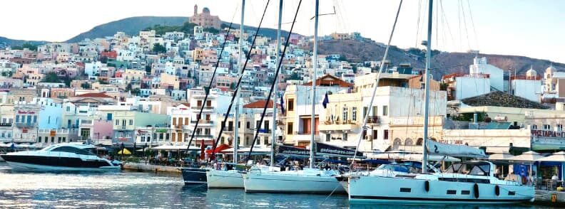
Siros
Siros is another almost empty island. The north is rocky and mainly uninhabited, while the south has gentler slopes and is cultivated by the coast.
Ermoupolis is on the east coast of the country. As the former capital of the Cyclades, the city has a certain grandeur with many fine structures.
Go bow or stern to the quay, avoiding the berth of the ferry to the east of the harbor. You’ll find fair shelter unless there are SE winds that bring a broad swell into the harbor, making it at best very unpleasant and at worst dangerous. Another danger is the sewage that goes through the harbor, making it very fragrant in the summer.
There’s also no drinking water on the quay, but it can be bought from a tanker. On the bright side, it’s a nice spot to go shopping and you’ll find plenty of tavernas across the harbor and in the entire area.
The tiny island of Nisos Gaidharos is just to the east. A little cove in the SE corner offers a good refuge from the Meltemi, but you won’t find any sort of facilities here.
Varis, in the southeast of Siros Island, offers a good grip and shelter from the Meltemi. In addition, it has lots of taverns on the waterfront.
The protected Finikas bay lies in the southwest of Siros. Go the bow or stern to the pier or drop the anchor to take advantage of the good holding of the sea bottom. There’s water on the dock, and you can connect to shore power. Furthermore, you’ll find showers and toilets on the pier and lots of shops in the village. This is a special spot to stop while sailing the Cyclades Islands and well worth a visit.
Galissas is located in the north of Siros. There’s a small mole south of the harbor and the depths are shallow, so take a long line to it. You’ll find a mini market and a pub on the beach.
Even farther north, there’s Kini, where you’ll find a small tavern and can shop for some small provisions.
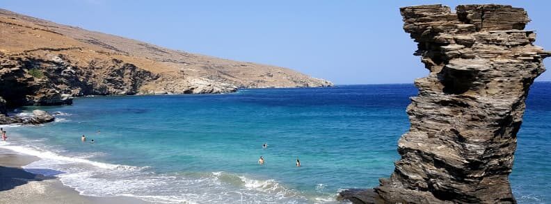
Andros
Andros is the northernmost island of the Cyclades. It is mountainous and densely forested with minimal agriculture.
Gaviron is located on the northwestern coast of Andros Island. You may anchor in the north side of the bay or go bow/stern to or alongside the quay. Besides a nice shelter from the Meltemi, you’ll also find fuel on the quay. Water and other provisions are available in the village. There are also tavernas by the sea and in the village.
Batsi is a small harbor just 2.5 miles south of Gaviron. Go bow or stern to the quay or drop anchor in the north or west of the port. Limited water access is available on the quay, while fuel and most provisions can be purchased in the village. There are tavernas on the beach, on the docks, and in the village.
Further south, you’ll come across the open bay of Palaioupolis. Anchor to the north of the bay and you’ll find the safest refuge from the Meltemi. The seas are crystal clear and the scenery is impressive.
Kastro, the capital of Andros Island, is on the E-side of the island. The port is accessible to the Meltemi, and it can be difficult to reach. Go bow or stern to behind the mole. Water, fuel, and equipment are available in the village, and there are tavernas both on the waterfront and in the village.
A stroll from the harbor of Kastro, across the bay to the village is very rewarding. Marine, archaeological, and contemporary art museums are all well worth a visit.
The open bay of Korthiou is only 6 miles south of Kastro. It’s possible to drop anchor in the harbor, but there is no protection against the Meltemi, and the resulting swell is at best painful, but can easily turn risky. You’ll find many tavernas onshore, but only limited provisions can be obtained here.
What to see on Andros while sailing the Cyclades Islands
- Venetian Fortress. On an island connected to the tip of the headland by the worn remains of an arched stone bridge, you’ll find the ruins of a Venetian fortress. It’s an ideal location for photos.
- Paleopolis. Ancient Andros and its sunken harbor are situated on the coast road about 7 kilometers south of Batsi.
- Arni.
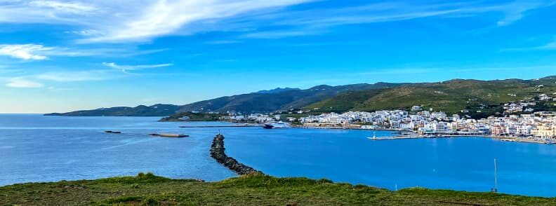
Tinos
Tinos is just another rocky mountainous island located just south of Andros. Tinos island is wooded and many of its hills have been covered with agriculture fields.
Tinos is the local port and capital. Go bow or stern to on the quay north of the inner harbor, avoiding the berth of the ferry. There’s a nice shelter, but the southerlies create some swell and the wash from the ferries can be uncomfortable. You’ll find water on the quay, and the locals say that it is the purest in Greece. Fuel can be purchased in the city, as can all other supplies. There is also a good number of tavernas by the harbor.
Panormos sits on the northeastern shore of Tinos. Go bow or stern to one of the two piers, but be careful near the smaller pier, since the depth is less than 2m, except at the extremity. There’s very little protection from the Meltemi, so Panormos should be avoided when it’s blowing.
What to see on Tinos while sailing the Cyclades Islands
- Panagia Evangelistria Tinos
- Kardiani and Isternia villages
- Tarampados
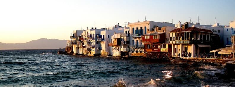
Mykonos
Mykonos, probably the most popular tourist spot in the Cyclades Islands, lies further south of Andros. Its capital and port have the same name, and it is the area that draws most tourists to the island. Go bow or stern to the dock in the NE of the harbor. The bottom is covered with weeds, and it’s hard to get the anchor to get a good grip.
There is little protection from the Meltemi, and some consider the port to be risky. A mini tanker is capable of delivering water and diesel. You’ll find a good number of shops in the city to buy any provisions you may need. There are also various tavernas for all sorts of budgets.
You’ll find a newer marina just over a mile north. This one offers decent all around protection.
Ornos Bay is on the south shore of Mykonos. Anchor in the north side of the bay where the bottom is sand and weed; in some areas the holding is bad. You’ll find a store in the vicinity of the bay and numerous beachfront tavernas.
Kalafatis, farther east, offers strong protection from the Meltemi but is open to the south and east. It has a pub on the beach.
The wide Panormos Bay is on the north shore of Mykonos Island. It cannot be used during the Meltemi season, but it’s nice otherwise. And it also has a pub on the beach.
There are more anchorages in Rinia, Chapel Bay, South Bay, and Miso, but none of them have any amenities.
What to see on Mykonos while sailing the Cyclades Islands
- Ano Mera
- Principote
The best beaches on Mykonos Island
- Paralia Agios Sostis
- Paralia Agios Stefanos
- Paradise Beach
- Paralia Super Paradise
Sailing the southern Cyclades Islands
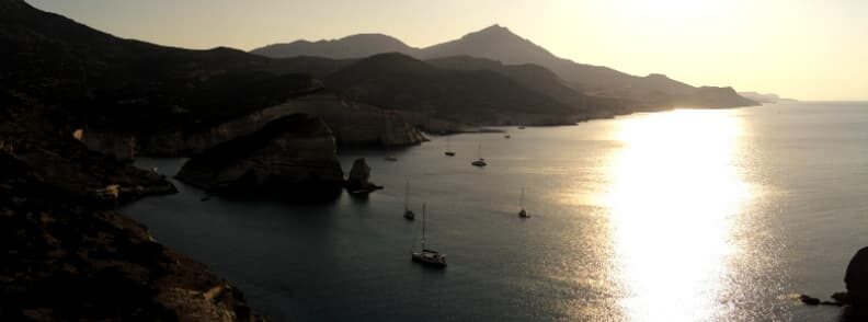
Milos
Milos is in the southwest of the Cyclades. Ormos Milou, a large bay, was scooped out when an ancient volcano erupted and hot sulfur springs still remain to this day.
Adamas is the port of the island. Go bow or stern to the east side of the ferry pier or bow to the smaller pier to the east. It is also possible to anchor the small pier in the southeast. The bottom is a combination of mud, rocks, and weeds, and in some places, there’s poor holding. While it’s a strong shelter from the Meltemi, the winds from the south will create unsafe conditions.
Water is available on the ferry pier and petrol can also be supplied. Most supplies can be bought in the village and there are several tavernas. While there are some other anchorages in the bay, they are exposed to the north and none of them have any facilities.
Climb the hill to the Chora of Milos for a stunning view of the bay.
Apollonia is in the north of Milos. Go down to the pier or anchor of the cove: the sandy bottom provides good holding. There are tavernas and a mini-market on the beach.
Ormos Voudhia sits one mile south of Apollonia. You’ll find a decent shelter from the Meltemi, but the surrounding area is unattractive, with open cast mines, a wharf, and an ore carrier all in sight.
What to see on Milos while sailing the Cyclades Islands
- Kleftiko Caves. Set sail from Adamas for Milos’ southwestern corner, where one of the country’s most photographed natural wonders awaits. Caves and natural arches can be found at the base of the cliffs and rocks. There is also a tunnel you can pass through and look up at the fascinating layered rock that forms the ceiling.
- Sarakiniko. Sarakiniko’s bone-white volcanic rocks have been sculpted into sinuous dunes and columns by the sea and wind. It’s like a moonscape, with no sign of vegetation, and you’ll definitely want to take pictures of the white rocks and crystalline, blue-green sea.
- Catacombs of Milos. This network of underground galleries near Trypiti is an early-Christian burial site, comparable to Rome’s catacombs and Jerusalem’s Mount of Olives.
- Ancient Theater of Milos. About 200 meters from the Catacombs, you can find an amphitheater with tiers of flawless Parian marble seats facing the natural harbor.
- Plaka Castle or the Venetian Castle of Milos. On the east side of the harbor near the village of Plaka, you’ll find a small stairway leading up the hill. Go up, pass by the two churches of Panagia Skiniotissa and Panagia Thalassitra and reach the 13th-century Venetian Castle at the top. An ideal hike at sunset, despite the crowds.
- Cave of Sykia. This is a collapsed sea cave with a small shingle beach in a breathtaking caldera of textured white cliffs. It can only be approached by boat and you can take your tender to get to the beach.
The best beaches on Milos Island
- Fyriplaka Beach is surrounded by cliffs streaked with red, brown, and yellow. The sand at the base of the cliffs is pale and fine, washed by calm waves until a southerly breeze blows. On all other days, children are perfectly safe playing in water that is just thigh-deep for a very long distance from the shore.
- Paliochori Beach is located southeast of Zefiria. It’s bounded by stratified rocks with red and yellow blotches and is a mixture of dark golden sand with shingles. The clear waters are warm, thanks to the numerous hot springs just below the surface. You are near a dormant volcano and the nearby restaurants serve food cooked with volcanic heat. Worth a try while sailing the Cyclades Islands.
- Firopotamos is not only a beach, but also a tiny fishing village. The whitewashed houses of the fishermen are built right next to the water’s edge, with blue-painted doors on the ground floors for their syrmata – boat storage areas. The beach has a mixture of pebbles and white sand, and it’s sheltered in a cove.
- Paliorema Beach is backed by the ghostly remains of a sulfur mine, making it more than just a spot to sunbathe and swim. In this area, you’ll find rusted heavy equipment, tracks with wagons, a waterfront loading crane, cave dwellings, and tunnel entrances that can all be explored.
- Tsigrado Beach. The only way down to this beach is through a steep and narrow crevasse in the rock unless you come by boat (after all, you’re sailing the Cyclades Islands). You’ll have to cling to a rope before descending the last few meters on a ladder.
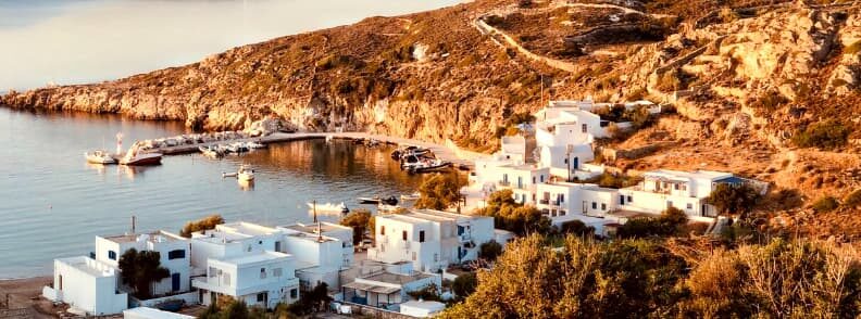
Kimolos
Kimolos is to the north of Milos. In Ormos Sikia, on the southwestern side of the island, there are two anchorages. They are both exposed to the N-NW winds, therefore unsuitable when the Meltemi blows.
Pirgonisi is a long sandy beach on the south coast and yachts can anchor almost anywhere in these attractive surroundings. You’ll find a good grip on the sand and weed sea bottom.
Psathi lies farther east along the coast. Go down to the quay or anchor off. You’ll have no protection from the Meltemi, and you should only use this anchorage in calm conditions. There are a few tavernas onshore and minimal facilities can be found in the village.
Semina Creek is just to the north, and boats can anchor in the harbor. Like Psathi, it offers no shelter from the Meltemi and should be avoided in rough conditions while sailing the Cyclades Islands.
Poliagos
There is a beautiful secluded anchorage in the northwest of Poliagos Island. You’ll find shelter from the Meltemi and a good holding on the sandy bottom. There are also several coves on the south side of the island where boats can drop anchor if the conditions are calm.
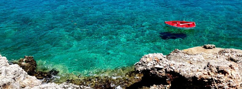
Folegandros
Folegandros is another desolate, rugged island you’ll discover while sailing in Cyclades Islands. The exception is the tiny Chora in the northeast, which sits between green trees and shrubs.
The ferry terminal of the islands is Karavostas. Go a bow or stern to the mole on the south side of the arm extending westward. Some areas with sand and rock on the bottom don’t allow good holding, but there’s reasonable shelter from the Meltemi. You’ll find several tavernas, but it can be difficult to shop for supplies and the island is totally dependent on ferry deliveries.
Ormos Vathi is a wide bay located on the western side of Folegandros Island. It can only be approached in calm conditions, and it has a poor holding in areas with sand and weeds, so you might want to avoid it while sailing the Cyclades Islands.
What to see on Folegandros while sailing the Cyclades Islands
- Chora of Folegandros. With its meandering main street flowing from square to square, with taverna tables bustling with life, this village is perhaps the most beautiful in the Cyclades.
- Ano Meria. This settlement is a fragmented cluster of small farms and homes that extends over many kilometers. This is typical Folegandros, where tourism is yet unobtrusive.
- Church of Panagia (Virgin Mary)
The best beach of Folegandros is Paralia Livadaki, so make sure you check it out while sailing the Cyclades Islands.
Sikinos
Sikinos is to the east of Folegandros. Ormos Skala is the only port on the island to stop when sailing in Cyclades Islands. Boats can go side to the quay or anchor off. There are tavernas by the sea, and some supplies are available for visitors. This destination is very attractive and popular with Greek sailors.
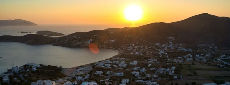
Ios
Ios lies 3.5 miles east of Sikinos. Homer is said to be buried here. He died aboard a ship on the way from Samos to Athens, and his body was thrown overboard and washed over Ios later.
Go bow or stern to in Port Ios. The anchor will have an outstanding grip in the mud. A mini-tank can deliver fuel and water is available from a public fountain in the square. You’ll find tavernas all over the harbor, where most provisions can be purchased.
This resort is popular with young people, and most bars play loud music in the evenings and nights.
Ormos Milopotamou sits on the south side of Port Ios. You’ll see four coves in the north of the bay where yachts can anchor; the one on the east offers the best shelter. The holding is good on the sandy bottom. There are tavernas and hotels on the beach.
Ormos Manganari is a wide bay on the south coast of Ios. It’s possible to anchor across the bay with a strong holding in the sand when sailing the Cyclades Islands. There are several tavernas on the beach.
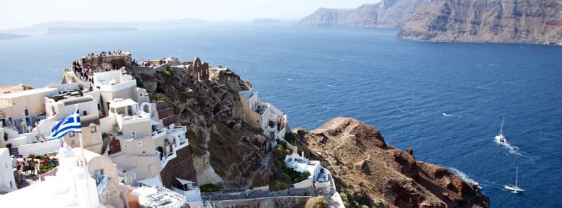
Thira (Santorini)
This may just be the most famous among all Greek islands. Thira is close to Milos in the same sense as it is a volcano, and when it erupted in 1440 – 1450 BC, it formed the bay as it is today. The neighboring islands of Thirasia, Nea Kameni, and Palea Kameni are also part of this massive volcanic system. Around the reservoir, on cliffs 300m high, you can see white Cycladic houses with blue painted windows hung from black volcanic rocks that rise from the sea all together to make Thira one of the most popular destinations in Greece.
Finikia is on the northern side of Thira. Anchor to the west of the mole at 10 – 20m with a trip line, because the bottom is rocky and your anchor may get easily stuck. You’ll find limited shelter from the Meltemi and completely open to the southern winds and swell.
Skala Thira is the port of the island’s capital located on the steep slopes above. Go bow or stern to the quay, with a line to the big mooring buoy. Departure is difficult because many lines get attached to the buoy, and it is recommended that yachts are not left unattended. There’s water on the quay and a few tavernas in the harbor.
There are a number of anchorages on the coast south of Akrotiri that provide a good shelter from the Meltemi. The bottom is covered in sand, but there is often a ground swell that causes boats to roll badly.
Monolithos is a small port on the eastern coast. Go bow to the breakwater near its extremity with a long line. You’ll find a tavern and a shower on the shore.
What to see on Santorini while sailing the Cyclades Islands
- Fira. Santorini’s main town is a lively city, with hotels, cave flats, infinity pools, and fancy restaurants lining the caldera’s edge. They’re all a font for a maze of narrow streets lined with shops and many more bars and restaurants.
- Skaros Rock. A 20-minute hike will bring you to the church on this cliff. It’s lovely at sunset, you have a view over the cliffs of the island, slowly changing their dull color into fiery red and gold at sunset.
- Oia. Famous for its sunset, the village has houses in niches of volcanic rock on the caldera’s steep slope. For spectacular sunsets without the crowds, go to the parking lot leading to Amoudi Bay, the tiny fishermen’s port below, or watch the sunset from the sea while sailing the Cyclades Islands.
The best beaches on Santorini Island
- Red Beach or Paralia Kokkini is located near ancient Akrotiri, next (and kind of under) some impressive red cliffs. By boat, you can also go to the nearby White Beach (Paralia Aspri) and Black Beach (Mesa Pigadia).
- Perissa Beach is covered in black sand, pebbles, and pumice stone. Despite the nearby bars, tavernas, hotels, and shops, this black beach is fairly relaxed.
- Eros Beach.
Thirasia
Thirasia is the westernmost island, and Agios Nikolaos is the only anchorage you’ll find here while sailing the Cyclades Islands. Sailboats may anchor off, because the small pier is reserved for local boats. There are tavernas on the shore and some provisions are available in the village located on top of the cliffs.
Nea Kameni
Nea Kameni has a number of small inlets where the boat can be anchored when sailing in Cyclades Islands. A trip line should be used because the bottom is lined with rocks that are likely to snag your anchor.
Nea Kameni is known for having a problem with large rats, and there are many reports of these creatures getting aboard yachts. Bring protection for your lines and don’t let anything hang in the water to give them a chance to grab it. Or just avoid spending too much time here while sailing the Cyclades Islands.
Anafi
Anafi is the southernmost spot where you can stop while sailing the Cyclades Islands. It’s also one of the small Cyclades islands. It’s got an anchorage on the southern coast that’s exposed. The island is barren and parched, and if you choose to skip it, you won’t miss a lot.
For more harbors and anchorages while sailing the Cyclades Islands, use Navily. It’s one of our favorite sailing apps!

Mirela Letailleur is a Romanian travel blogger living in the South of France. She writes on The Travel Bunny travel blog about affordable travel in Europe, creator of unique free travel guides, local travel expert. Problem solver. Wannabe coffee guru.
After reading about sailing in the Cyclades Islands, check out
Sailing the Ionian Islands: Discover Greece by boat
Sailing in Croatia: 15+ destinations to see by boat
Our Bavaria 350 for sale in Greece

