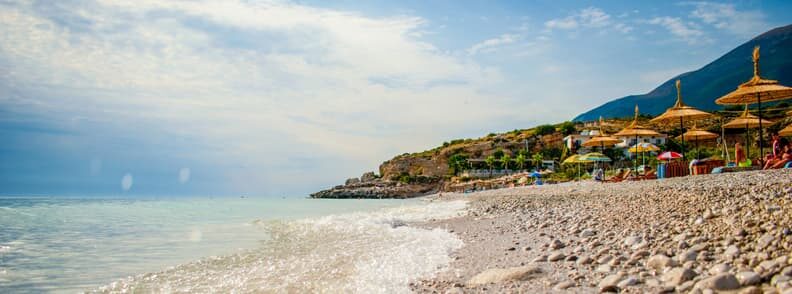
The Albanian Riviera, to the north of Saranda, is one of the most beautiful coastlines in the Ionian Sea. There were few positive outcomes from Albania’s isolation and poverty under communism, but this pristine coastline was one.
A few small resorts, provide families with the opportunity to spend a fortnight or so at the beach.
Because of the submarine base at Porto Palermo, the coastal road between Himara and Borsh was a closed military zone. Himara was a sleepy village, and Saranda was only a small, low-rise city. However, during the last 20 years, the Albanian Riviera’s beautiful beaches have been developed for tourists one after the other. Even the tiniest bays contain beach cafés and restaurants.
The Albanian Riviera is now an almost uninterrupted ribbon of hotels, restaurants, and exclusive villa projects stretching from the southern fringes of Saranda to the coastal promenade of Vlora. The cost of lodging ranges from basic rooms in private homes to expensive hotels. Many beaches feature summer-only campgrounds.
Prices skyrocket throughout the summer, so make your reservations early. Although most hotels state that they take credit cards, the systems are not always reliable, so bring plenty of cash.
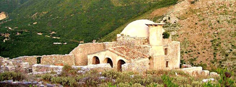
Borsh
A tiny road up to the right immediately before the settlement of Borsh, about an hour and a half from Saranda, goes up to Borsh Castle, also known as Sopoti Castle. It was first mentioned in writing in 1258, and the hill on which it lies was already fortified by the 4th century BC.
What is visible today, however, comes from the 18th century. The mosque at the entry was constructed during the period, and the painted ceiling and walls must have been lovely when the fresco was in better condition. The entire castle is abandoned and overgrown, but the views from it are excellent, looking out across the Ionian Sea to Corfu in one direction and towards the mountains that run the length of the Albanian Riviera in the other. There is a paved walk leading up from the parking lot to just beyond the castle door, with stone seats for resting and admiring the views
If you’re walking, stop at the Ujvara Restaurant, a charming spot for dinner or a drink, with tables set on terraces surrounded by waterfalls (ujvara in Albanian). It’s a good spot to start your walk – just ask the servers to show you the shortcut up to the road. The walk up to the castle entrance from the restaurant takes around 30 minutes.
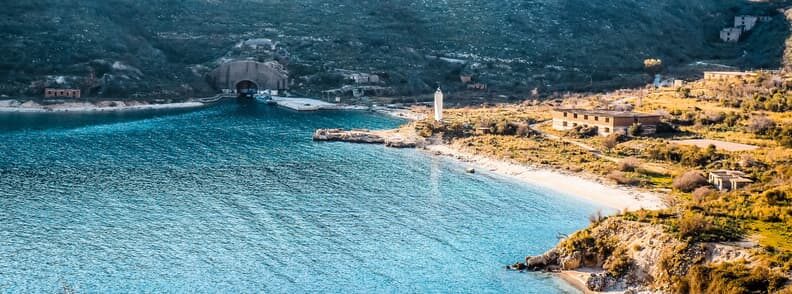
Porto Palermo
After Borsh, the road descends to the coast and round Porto Palermo, where Ali Pasha Tepelena erected one of his spectacular fortifications on a point connected to the mainland by a small and easily defendable bridge. The promontory blocks off a portion of this lovely Albanian Riviera bay, forming a protected harbor frequented by local fishermen and a beautiful pebbly beach.
Cars can be parked either at the restaurant on the main road or just beyond the causeway, next to a restored church and ruined 20th-century buildings, with communist-era slogans still visible beneath the more recent graffiti.
The Porto Palermo Castle is a few minutes walk up a rocky route. At the beginning of the trail, there is an information board with useful maps of the stronghold and a brief history of it in English and Albanian.
The castle’s interior consists of a large domed hall with archways going off it into smaller chambers and dark tunnels (a flashlight is required), which are well worth exploring thoroughly. A stone stairway goes up to the battlements, from which you can see some of the outer walls. The vistas are breathtaking. The islands visible in the distance are Greek territory, located northwest of Corfu. Not unexpectedly, the slope overlooking the water is densely fortified with bunkers. During and maybe after the Italian occupation, the stronghold was utilized as military storage.
From the castle and at various locations along the route, you can see a massive tunnel dug into the rocks on the bay’s northern side. It was created in the late 1950s as a refuge for the Soviet Union’s submarines stationed in the Adriatic. When the Soviet Union severed ties with China and Albania allied with China, the USSR rightly demanded the return of its submarines. Four of the eight submarines were left behind after a weeks-long standoff. These incidents were portrayed in Ismail Kadare’s 1979 film Face to Face.
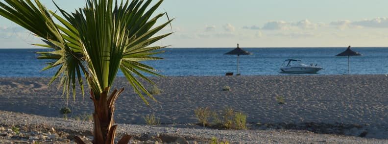
Himara
Himara is the most populous town between Saranda and Vlora on the Albanian Riviera, featuring a high school, district hospital, ATMs, and other amenities. This is the place to go if you find Saranda Albania overdeveloped. It offers nice hotels and restaurants, the service is better than in some other Albanian Riviera destinations, and the locals are pleasant and helpful.
Himara’s swimming is superb, with beautiful blue water that remains warm until late in the year. The town center no longer has much of a beach, since much of it has been replaced by a huge length of the promenade, but the terraces of the pubs and restaurants behind it are excellent places to relax and observe the sea.
- Potami Beach, just south of town, is pebbled, but the hotels there provide sun loungers and the sea is clear.
- Two nearby quieter beaches are Livadhja Beach, located just a 25-minute walk beyond the football pitch, and Llamani Beach, a picturesque cove only a 10-minute drive south.
Non-swimmers should be aware that, in contrast to the calm Adriatic coast farther north, the beach drops rather abruptly into the water in this area of the Albanian Riviera.
Excavation in the Spile cave discovered traces of Neolithic occupancy. The cave is located near the intersection of the main road and the promenade.
Old Himara, located above the contemporary town, is commonly referred to as Himara Castle, and it was fortified in the 5th-4th century BC when Himara was part of Chaonia. In the 6h century AD, Procopius of Caesarea cites it as one of Justinian’s restored castles. It currently contains an astounding number of churches in various states of disrepair, some of which have wonderful frescoes.
Spile to Old Himara is a delightful and picturesque 30-45-minute stroll on the Albanian Riviera.
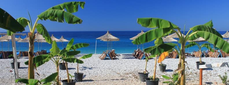
The Northern Albanian Riviera
The breathtaking views of the Albanian Riviera continue north of Himara, with towering mountains rising from the shore and the deep blue water glistening in the sunlight. The route passes past the charming settlements of Vunoi and Dhermi. Below these, and below the road, there are beautiful beaches with fine, clean sand, clear blue water, lots of accommodation, and vibrant nightlife in the summer.
- Jala Beach is 5 kilometers from the main road, immediately before the first residences in Vunoi
- Dhermi Beach is 1.5 kilometers from the road.
Both beaches are adequately marked, and both roads are well maintained. There is no public transportation to these Albanian Riviera beaches. If you’re traveling by bus, I recommend you ask to be dropped off at the Plazh (beach in Albanian) and then walk or hitchhike down the hill.
The road begins to ascend towards the Llogara Pass a few kilometers past Dhermi. The opulent villas with sea views on the present-day Albanian Riviera are a far cry from the untamed coast where Julius Caesar arrived from Brundisium (present-day Brindisi) in 48BC to pursue his rival, Pompey.
The settlement of Palasa is located on the mountain to the right. To the left lies Palasa Beach, which is roughly 3.5 kilometers from the motorway and is now practically privatized.
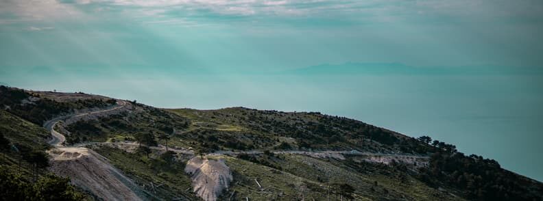
Llogara Pass
The hairpin turns ahead of Palasa lead to the Llogara Pass, which rises more than 1,000 meters above sea level. As the road climbs above the beautiful Albanian Riviera beaches, a tourist information kiosk and viewpoint are located in a lay-by on the left. The naked peaks of the Çika Mountains, 2,045 meters at their highest point, are on your right, with pines and firs shrouding the hillside below them. The cliffs to your left descend nearly steep into the Ionian Sea, which is as wine-dark as it was when Odysseus sailed it.
Over 1,000 hectares of land surrounding the pass’s summit has been declared as a national park. This area on the Albanian Riviera is abundant in wildlife (roe deer, foxes, squirrels, wild boar, and wolves are prevalent) and would be an ideal base for a few days of hiking.
A short climb to Caesar’s Pass or Qafa e Çezarit, where Julius Caesar is said to have led his forces through the mountains following their landing at Palasa, requires little more than decent fitness and suitable shoes. The unmarked trail ascends from the right side of the road, roughly opposite the Sofo hotel and restaurant. The hike through the pinewoods takes 20-30 minutes before reaching more open ground and a viewpoint with breathtaking views of the tip of the Karaburuni Peninsula and the Adriatic.
A decent round climb takes you up to the Deep Pass or Qafa e Thellë, up the ridge to the phone towers, and back down to the pass’s summit. The walk begins at an evident position between the Iliria Restaurant and the Hotel Alpin. The path is paved and in generally good shape, but suitable footwear should be worn for this hike on the Albanian Riviera.
Hiking across Qafa e Thellë to the start of the Karaburuni Peninsula and Caesar’s landfall at Palasa is feasible, but the trails on the opposite side of the mountain are rough and obscure. Traveling with a local guide is strongly recommended.
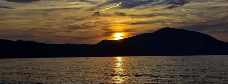
Orikum
The route emerges from the Llogara woodlands onto the diverse environment of the Adriatic coast. The Karaburuni Peninsula separates the Ionian and Adriatic seas. It creates a protective arc surrounding the Bay of Vlora on the Albanian Riviera, forming a secure harbor that was initially utilized in the 6th century BC: Oricum.
Orikum, a contemporary town with a large pebble beach, is a popular holiday destination, particularly among Albanian families. It has a health center, ATMs, cell phone service providers, and a post office.
An active naval installation and the ancient site of Oricum are located at the far end of Orikum’s coastline, where the Karaburuni Peninsula begins to curve up to the north. Colonists from the Greek island of Euboea constructed this ancient city in the sixth century BC. Because of its strategic location and great harbor, it grew into a major trade station, defended by the peninsula known as Acroceraunia. Oricum started minting its own coins by the third century BC. During the First Macedonian War (214-205BC), Philip V of Macedon controlled it briefly. Subsequently, during the Roman Civil War, it easily succumbed to Julius Caesar after he arrived with his forces on the other side of the Llogara Pass.
Oricum was discovered in the 1950s, but a thorough investigation has just recently begun, led by the Albanian Institute of Archaeology and the University of Geneva. Albanian and Swiss archaeologists have found three unique eras of construction for this gate – Hellenistic, late antique, and medieval – as well as a portion of the city walls that stretch 30m underwater.
The most well-known landmark in the city is an ornate fountain, or nymphaeum, constructed right into the hillside and overlooking the sea.
Despite being in a military zone, the archaeological site is available to the public. You should bring your passport or ID card to show the gate guards. And if you’re visiting the Albanian Riviera during the summer, keep in mind that a guide is normally on duty at the site from around 09.00 until luncheon on weekdays.
The final stretch of beach lies on a spit of land that separates the sea from the Pashaliman Lagoon, a marshy, reeded region. The lagoon is a critical habitat for waterfowl and other species, including cattle egret. These lovely birds may even be seen grooming cows in fields along the wayside on their way from the coast to Vlora. Warblers, pygmy cormorants, and marsh harriers also live in the reed beds.
The 12th-century Church of Marmiroi perches on a hillside on the outskirts of the marshes. Within the religious edifice, there are three magnificent frescoes: a Virgin with Child, John the Evangelist, and (slightly repaired) St Michael. Its lofty cupola may be seen from afar, but getting to it is difficult due to the reed marshes that surround it. Cross the irrigation canal and continue the trail around the reed beds until you reach a firm path through the reeds on the western border of the town.
With the Vlora Bypass opened on 7 July 2022, the coastal route along the Bay of Vlora will become mostly used for tourism. Beginning with Rradhima, with a long pebble beach crowded with sun loungers during peak season, there will be plenty of seaside resorts to choose from along the route.
Tragjas
Tragjas is a settlement in the low hills near Orikum. Cooler than the beach, it is popular with Albanian vacationers in the summer and becomes quite busy, with performances by well-known Albanian singers and bands.
Tragjasi i Vjetër or Old Tragjas is around 300m above sea level, higher than the current settlement. It’s estimated to have been erected in the 14th or 15th centuries and was burnt and rebuilt three times throughout the Ottoman Empire. It was later burned down twice more during WWII, once by the Italians in 1939 and once by the Germans in 1942. Instead of reconstructing after the war, the people relocated downhill, closer to their farms, and constructed new homes to establish the contemporary community. Old Tragjas had been abandoned.
The road to Old Tragjas is not asphalted, but it may be driven in any relatively durable automobile all the way to the cemetery, which is still used by modern locals. The ancient village may be seen from here on its hilltop, although it is separated from the cemetery by a riverbed (dry in summer) that can only be crossed by 4×4 vehicles. The destroyed homes are a very difficult three-hour trek up from the current settlement.

Mirela Letailleur is a Romanian travel blogger living in the South of France. She writes on The Travel Bunny travel blog about affordable travel in Europe. Creator of unique free travel guides and local travel expert. Problem solver. Wannabe coffee guru.
Other destinations to discover after the Albanian Riviera
Visit Berat Albania: a short travel guide
Why you have to visit Shkoder Albania
Tirana Albania’s colorful and creative capital

